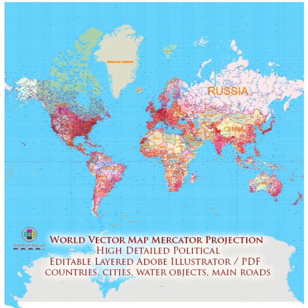
The World Mercator Projection is a cylindrical map projection that was developed by Gerardus Mercator in 1569. It is one of the most well-known and widely used map projections, especially for navigation purposes.
Vectormap.Net provide you with the most accurate and up-to-date vector maps in Adobe Illustrator, PDF and other formats, designed for editing and printing. Please read the vector map descriptions carefully.
Here are some key features, advantages, and disadvantages of the World Mercator Projection:
Key Features:
- Cylindrical Projection: The Mercator Projection is a cylindrical projection, which means that it represents the Earth’s surface as if it is wrapped around a cylinder.
- Preservation of Angles: One of the major features of the Mercator Projection is that it preserves angles. This makes it particularly useful for navigation, as straight lines on the map represent courses of constant compass direction.
- Equidistant: The projection maintains true scale along the equator, meaning that distances measured along the equator are accurate.
- Conformal: The Mercator Projection is conformal, which means that it preserves local shapes and angles. This property is especially beneficial for navigation, as it allows sailors to maintain accurate bearings.
- Useful for Navigation: Due to its conformal nature and preservation of angles, the Mercator Projection has historically been used for navigation, especially in marine navigation.
Advantages:
- Navigation: The Mercator Projection is particularly well-suited for navigation purposes, especially for sea travel, as straight lines on the map represent constant compass bearings.
- Conformality: The conformal nature of the projection makes it valuable for maintaining accurate shapes and angles in local areas, which is beneficial for navigation and certain types of mapping.
- Familiarity: The Mercator Projection is widely recognized and used, contributing to its familiarity and ease of understanding for many people.
- Ease of Use: The projection is relatively straightforward to use and understand, which makes it popular for educational purposes and general reference maps.
Disadvantages:
- Distortion: One of the significant drawbacks of the Mercator Projection is the distortion it introduces towards the poles. Areas become highly distorted as they move away from the equator, leading to an exaggeration of size, especially for land masses near the poles.
- Area Distortion: The projection significantly distorts the relative size of land masses. For example, Greenland appears much larger on a Mercator map than it actually is in reality.
- Not Equal Area: The projection is not equal area, meaning that the sizes of land masses are not accurately represented. Larger land masses, particularly near the poles, are disproportionately enlarged.
- Limited Applicability for Polar Regions: The Mercator Projection is not suitable for mapping polar regions effectively due to extreme distortion. Greenland, for example, appears much larger than it actually is.
In summary, while the Mercator Projection is valuable for navigation and certain types of mapping, its significant distortions, particularly in terms of area, limit its applicability for global or equal-area representation. Different map projections are chosen based on the specific requirements of a given task or application.


 Author: Kirill Shrayber, Ph.D. FRGS