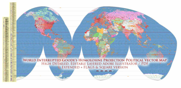
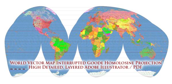
The Goode’s Homolosine projection is a pseudocylindrical, equal-area map projection designed to minimize distortion in the representation of landmasses. Developed by John Paul Goode in 1923, this projection aims to balance various map properties.
Vectormap.Net provide you with the most accurate and up-to-date vector maps in Adobe Illustrator, PDF and other formats, designed for editing and printing. Please read the vector map descriptions carefully.
Here are key features of Goode’s Homolosine projection:
- Equal Area:
- One of the primary features of Goode’s Homolosine projection is that it maintains equal area properties. This means that the projection accurately represents the relative sizes of different regions on the Earth’s surface.
- Pseudocylindrical Shape:
- The projection combines elements of both cylindrical and interrupted projections. It uses multiple segments that resemble sections of a cylinder, but they are not continuous.
- Interrupted Projection:
- Goode’s Homolosine projection is an interrupted projection, meaning it divides the Earth’s surface into sections to minimize distortion. These sections are usually shown as separate, non-contiguous “lobes.”
- Minimized Distortion:
- The interrupted nature of the projection allows for the minimization of distortion in both shape and area. While individual sections may experience some distortion, overall distortion is reduced compared to other projections.
- Oceans are Continuous:
- Unlike some interrupted projections where interruptions may extend into the oceans, Goode’s Homolosine projection typically maintains a continuous representation of the oceans. This makes it suitable for thematic maps that require a focus on land areas.
- Compromise Projection:
- Goode’s Homolosine is considered a compromise projection because it attempts to balance several map properties, such as shape, area, and distance. It doesn’t excel in any single aspect but aims to provide a reasonable compromise.
- Attractive Aesthetics:
- The interrupted projection, with its distinctive lobes, can be visually appealing. The map is often chosen for its aesthetic qualities, especially when used for educational or illustrative purposes.
- Use in Education:
- Goode’s Homolosine projection is often used in educational settings to teach students about map distortions and the challenges of representing a three-dimensional object on a two-dimensional surface.
It’s important to note that, like any map projection, Goode’s Homolosine has its limitations, and users need to be aware of the specific distortions introduced in the representation of the Earth’s surface. The choice of map projection depends on the purpose of the map and the aspects of geography that are most important for a given application.


 Author: Kirill Shrayber, Ph.D.