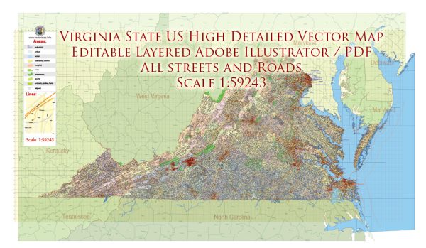
Virginia is a state located in the southeastern part of the United States. It is known for its rich history, diverse geography, and economic significance.
Vectormap.Net provide you with the most accurate and up-to-date vector maps in Adobe Illustrator, PDF and other formats, designed for editing and printing. Please read the vector map descriptions carefully.
Here’s a detailed description of some of the main cities, ports, towns, and principal roads in Virginia:
Main Cities:
- Richmond:
- Capital of Virginia.
- Historic city with significant Civil War sites.
- Economic hub with a diverse economy.
- Virginia Beach:
- A popular tourist destination with a long coastline and a famous boardwalk.
- Largest city by population in Virginia.
- Home to several military bases.
- Norfolk:
- Major port city on the Chesapeake Bay.
- Houses the largest naval base in the world.
- Key economic center with a focus on shipping and defense.
- Arlington:
- Adjacent to Washington, D.C., Arlington is known for the Pentagon and Arlington National Cemetery.
- Suburban character with a mix of residential and commercial areas.
- Alexandria:
- Historic city with a well-preserved Old Town.
- Located along the Potomac River, close to Washington, D.C.
- Offers a blend of historical charm and modern amenities.
- Roanoke:
- Located in the western part of the state.
- Known as the “Star City of the South.”
- Economic and cultural center for southwestern Virginia.
- Charlottesville:
- Home to the University of Virginia.
- Historical significance, including Monticello, the home of Thomas Jefferson.
- Cultural and educational hub.
Ports:
- Port of Virginia:
- Includes the ports of Norfolk, Portsmouth, and Newport News.
- One of the largest and busiest port complexes on the East Coast.
- Handles containerized cargo, bulk cargo, and military shipments.
Towns:
- Williamsburg:
- Famous for Colonial Williamsburg, a living history museum.
- Historic area showcasing 18th-century American life.
- Fredericksburg:
- Located along the Rappahannock River.
- Historic town with Civil War battlefields.
- Lynchburg:
- Central Virginia city along the James River.
- Known for its scenic beauty and historical sites.
Principal Roads:
- Interstate 95 (I-95):
- Major north-south interstate running through Virginia.
- Connects cities like Richmond, Fredericksburg, and Alexandria.
- Interstate 64 (I-64):
- East-west interstate connecting cities like Richmond, Newport News, and Norfolk.
- Route 66:
- East-west highway connecting Northern Virginia with the Shenandoah Valley.
- Route 29:
- North-south highway connecting Washington, D.C., and Charlottesville.
- Route 460:
- East-west highway connecting the Hampton Roads area with Lynchburg and Roanoke.
- Chesapeake Bay Bridge-Tunnel:
- Connects the Eastern Shore with the mainland, providing a crucial transportation link.
This overview provides a glimpse into the diverse regions and features of Virginia, but it’s important to note that the state has many more cities, towns, and roadways that contribute to its unique character and significance.


 Author: Kirill Shrayber, Ph.D.