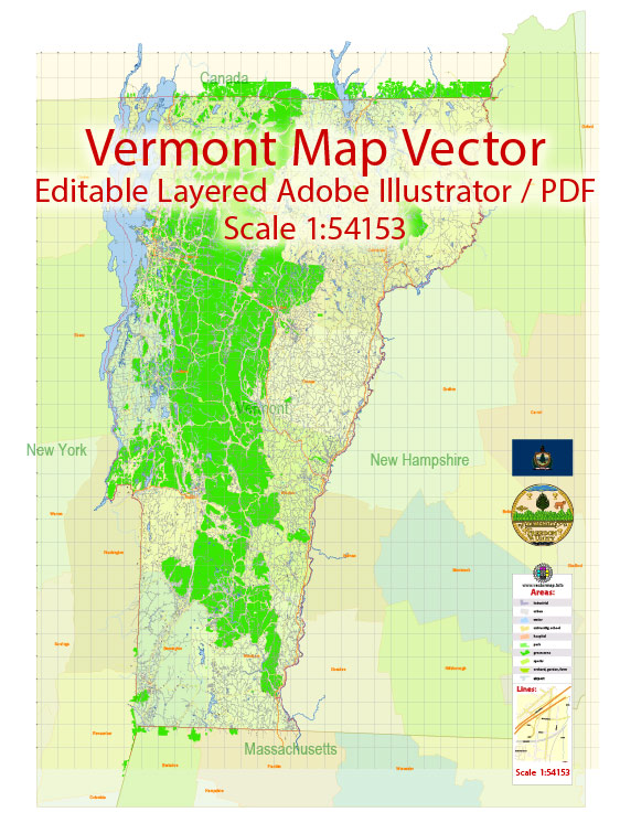
A general information about some of the main cities and towns in Vermont, here is a brief overview of the state’s principal roads.
Vectormap.Net provide you with the most accurate and up-to-date vector maps in Adobe Illustrator, PDF and other formats, designed for editing and printing. Please read the vector map descriptions carefully.
Cities and Towns:
- Burlington:
- Largest city in Vermont, located on the eastern shore of Lake Champlain.
- Known for its vibrant downtown, cultural events, and the University of Vermont.
- Montpelier:
- State capital, known for being the smallest capital city in the United States.
- Rich in history, with a charming downtown area.
- Rutland:
- Third-largest city in Vermont, located in the south-central part of the state.
- Historically known for its marble industry.
- South Burlington:
- Adjacent to Burlington, it is one of the state’s largest retail centers.
- Essex Junction:
- Located in Chittenden County, known for its historical sites and proximity to Burlington.
- Stowe:
- Famous for its ski resort and picturesque landscapes.
- A popular destination for outdoor activities.
- Middlebury:
- Home to Middlebury College, a prestigious liberal arts institution.
- Quaint town with historic architecture.
- Brattleboro:
- Located in the southeastern part of the state, near the border with New Hampshire.
- Known for its arts scene and vibrant community.
- Bennington:
- Located in the southwestern part of the state.
- Historic town with landmarks such as the Bennington Battle Monument.
Principal Roads:
- Interstate 89 (I-89):
- Connects Vermont with New Hampshire, running north-south.
- Interstate 91 (I-91):
- Runs along the eastern border, connecting Vermont to Massachusetts and Canada.
- Interstate 93 (I-93):
- Extends briefly into Vermont from Massachusetts.
- U.S. Route 7 (US 7):
- Runs north-south through the western part of the state, connecting several cities.
- U.S. Route 2 (US 2):
- Crosses northern Vermont, connecting with New Hampshire.
- Vermont Route 100 (VT 100):
- Scenic route running north-south, passing through Stowe and other picturesque areas.
- Vermont Route 9 (VT 9):
- Connects Bennington in the west to Brattleboro in the east.
- Vermont Route 15 (VT 15):
- East-west route connecting Burlington and Winooski.
Please note that road networks and city developments may have changed since my last update. For the most current and detailed information, I recommend checking with the Vermont Department of Transportation or other relevant local sources.


 Author: Kirill Shrayber, Ph.D.