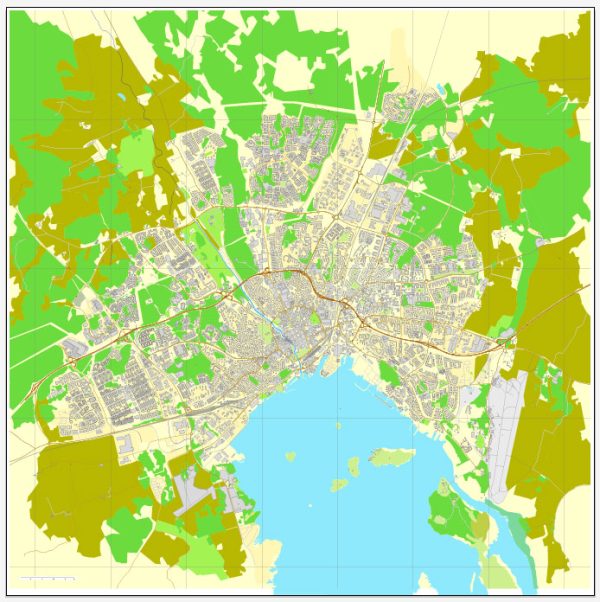
Västerås is a city in central Sweden and the seat of Västerås Municipality in Västmanland County.
Vectormap.Net provide you with the most accurate and up-to-date vector maps in Adobe Illustrator, PDF and other formats, designed for editing and printing. Please read the vector map descriptions carefully.
- City Center:
- Main Streets: Stora Gatan and Vasagatan are two prominent streets in the city center. Stora Gatan is known for its shops, restaurants, and historic buildings.
- Djäkneberget:
- This area is located near Lake Mälaren and offers picturesque views. It is known for its parks and green spaces.
- Västerås Harbor:
- Situated along the shores of Lake Mälaren, the harbor area is likely to have a mix of residential and commercial spaces. The waterfront may feature recreational areas and walking paths.
- Skallberget:
- A residential area that may include schools, parks, and local amenities.
- Vallby:
- Known for Vallby Open Air Museum, showcasing rural and urban life in Sweden during the 19th and early 20th centuries.
- Hemdal:
- Another residential area, likely with schools, parks, and local services.
- Rocklunda:
- Home to the Rocklunda Sports & Event arena, which hosts various sports and entertainment events.
- Erikslund:
- Includes the Erikslund Shopping Center, providing shopping and dining options.
- Bäckby:
- A residential area with schools, parks, and local facilities.
- Skiljebo:
- This district may have a mix of residential and commercial areas with local services.
- Sala Highway (Sala Highway 56):
- A major road connecting Västerås to Sala and other nearby areas.
- E18 Highway:
- The E18 highway runs east-west and is a significant transportation route connecting Västerås to other cities in Sweden.
Please keep in mind that this is a general overview, and the city’s development may have led to changes in specific neighborhoods, streets, or districts. To get the most accurate and up-to-date information, it’s recommended to consult local sources, municipality websites, or visit Västerås tourism resources for the latest details on districts, communities, and main streets.


 Author: Kirill Shrayber, Ph.D. FRGS