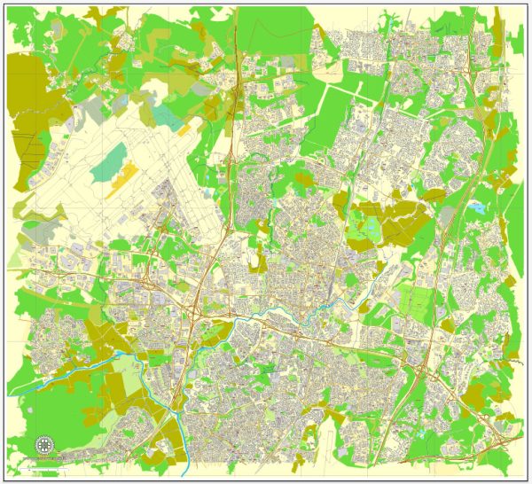
Vantaa is a city in southern Finland, and it is one of the major cities in the Greater Helsinki metropolitan area.
Vectormap.Net provide you with the most accurate and up-to-date vector maps in Adobe Illustrator, PDF and other formats, designed for editing and printing. Please read the vector map descriptions carefully.
Here’s a general overview of Vantaa’s districts, communities, and some main streets:
- Tikkurila:
- Description: Tikkurila is a central district in Vantaa and serves as the administrative and cultural center of the city. It’s known for its transportation hub, including the Tikkurila railway station and the Vantaa bus station. The area has various services, shopping centers, and cultural facilities.
- Main Streets: Tikkurilantie, Ratatie, Asematie.
- Myyrmäki:
- Description: Myyrmäki is another significant district in Vantaa, offering a mix of residential and commercial areas. It has a large shopping center, Myyrmanni, and is known for its sports and recreational facilities.
- Main Streets: Myyrmäenraitti, Iskoskuja, Paalutori.
- Korso:
- Description: Korso is a suburban district in the northern part of Vantaa, known for its residential areas and local services. It has parks and recreational spaces for residents.
- Main Streets: Korsotie, Korsonraitti, Ylästöntie.
- Aviapolis:
- Description: Aviapolis is an area located near Helsinki Airport and is known for its business and technology parks. It’s a hub for various international companies, and there are ongoing developments to enhance its infrastructure.
- Main Streets: Helsinki-Vantaa Airport is a significant landmark with well-connected roads around the area.
- Malmi:
- Description: Malmi is located in the northeastern part of Vantaa and is characterized by a mix of residential and industrial areas. It has historical significance, with some older buildings and structures.
- Main Streets: Malmin kauppatie, Pohjolankatu, Malminrinne.
- Pakkala:
- Description: Pakkala is a growing residential area in Vantaa, known for its modern housing developments. It’s strategically located between Tikkurila and Aviapolis.
- Main Streets: Pakkalankuja, Pakkalantie.
Please keep in mind that these descriptions are general overviews, and the city may have undergone changes or developments since my last update. For the most accurate and current information, it is advisable to refer to local sources, city planning documents, or official Vantaa city websites.


 Author: Kirill Shrayber, Ph.D.