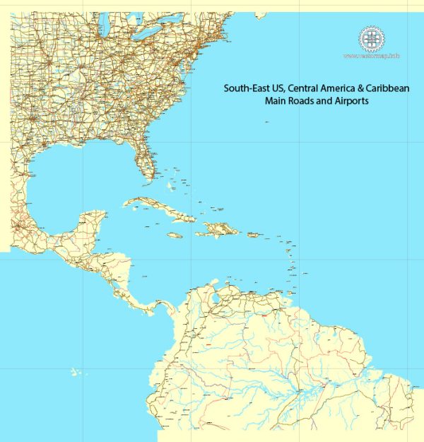
A general overview of the main cities, airports, and principal roads in the Southeastern part of the United States. The Southeast is a region known for its rich history, diverse culture, and vibrant landscapes.
Vectormap.Net provide you with the most accurate and up-to-date vector maps in Adobe Illustrator, PDF and other formats, designed for editing and printing. Please read the vector map descriptions carefully.
Main Cities:
- Atlanta, Georgia:
- Hartsfield-Jackson Atlanta International Airport (ATL) is one of the busiest airports globally.
- Major highways include I-75, I-85, and I-285.
- Charlotte, North Carolina:
- Charlotte Douglas International Airport (CLT) is a major hub.
- Key highways include I-77 and I-85.
- Miami, Florida:
- Miami International Airport (MIA) is a major gateway to Latin America.
- Important roads include I-95 and I-595.
- Orlando, Florida:
- Orlando International Airport (MCO) serves as a major tourist destination.
- Significant highways include I-4 and Florida’s Turnpike.
- Raleigh-Durham, North Carolina:
- Raleigh-Durham International Airport (RDU) is a major airport.
- Key highways include I-40 and I-540.
- Nashville, Tennessee:
- Nashville International Airport (BNA) is a significant transportation hub.
- Major highways include I-40 and I-65.
- Jacksonville, Florida:
- Jacksonville International Airport (JAX) serves the northeastern Florida region.
- I-95 is a major interstate passing through Jacksonville.
- Tampa, Florida:
- Tampa International Airport (TPA) is a major airport on the west coast.
- Key highways include I-75 and I-275.
Major Airports:
- Hartsfield-Jackson Atlanta International Airport (ATL) – Atlanta, Georgia
- Charlotte Douglas International Airport (CLT) – Charlotte, North Carolina
- Miami International Airport (MIA) – Miami, Florida
- Orlando International Airport (MCO) – Orlando, Florida
- Raleigh-Durham International Airport (RDU) – Raleigh-Durham, North Carolina
- Nashville International Airport (BNA) – Nashville, Tennessee
- Jacksonville International Airport (JAX) – Jacksonville, Florida
- Tampa International Airport (TPA) – Tampa, Florida
Principal Roads:
- Interstate 75 (I-75): Runs from Miami, Florida, to Sault Ste. Marie in Michigan, passing through cities like Atlanta, Georgia.
- Interstate 85 (I-85): Connects Montgomery, Alabama, to Petersburg, Virginia, passing through Atlanta and Charlotte.
- Interstate 95 (I-95): Major north-south interstate, stretching from Miami, Florida, to Houlton, Maine, passing through Jacksonville.
- Interstate 4 (I-4): Runs across Florida, connecting Tampa and Orlando.
- Interstate 40 (I-40): Spans from Barstow, California, to Wilmington, North Carolina, passing through Nashville and Raleigh.
- Interstate 595 (I-595): Connects I-75 and I-95 in the Miami metropolitan area.
- Interstate 540 (I-540): Forms a partial loop around Raleigh, North Carolina.
- Florida’s Turnpike: A toll road running north-south through the state of Florida.
These cities and transportation infrastructure contribute to the economic, cultural, and social vibrancy of the Southeastern United States.


 Author: Kirill Shrayber, Ph.D. FRGS