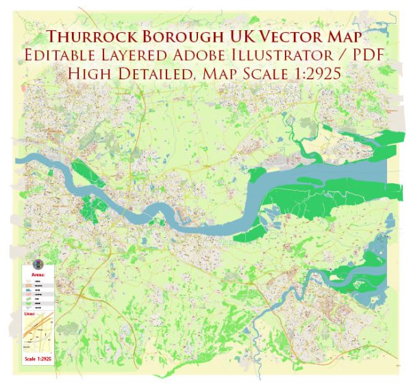
Thurrock is a borough in Essex, England, situated on the north bank of the River Thames. It has a rich history, with various historic places, buildings, streets, and squares that reflect its heritage.
Vectormap.Net provide you with the most accurate and up-to-date vector maps in Adobe Illustrator, PDF and other formats, designed for editing and printing. Please read the vector map descriptions carefully.
Here are some notable features:
- Coalhouse Fort:
- Location: East Tilbury
- Description: Coalhouse Fort is a Victorian coastal defense fort built in the 1860s to guard against potential naval attacks. It played a role in both World Wars and is now a museum open to the public, offering insights into military history and architecture.
- Tilbury Fort:
- Location: Tilbury
- Description: Tilbury Fort is an impressive artillery fort constructed in the 16th century during the reign of Henry VIII. It has played a crucial role in defending the Thames estuary throughout history and has been expanded and modified over the centuries.
- Grays High Street:
- Location: Grays
- Description: Grays High Street is the main thoroughfare in the town of Grays, and it features a mix of historic and modern architecture. The street is lined with shops, restaurants, and pubs, providing a glimpse into the local lifestyle.
- Orsett Hall:
- Location: Orsett
- Description: Orsett Hall is a historic mansion dating back to the 17th century. Originally a family home, it has been repurposed over the years and is now a hotel and wedding venue. The building’s architecture reflects its historical significance.
- Purfleet Quay:
- Location: Purfleet
- Description: Purfleet Quay is an area along the River Thames that has historical significance as a trading and shipping location. While the original quays have been modernized, the area still retains some of its historic charm.
- St. Clement’s Church:
- Location: West Thurrock
- Description: St. Clement’s Church is a Grade I listed building with a history dating back to the 12th century. The church has undergone various renovations, and its architecture reflects different periods, including Norman and Gothic styles.
- Stanford-le-Hope Conservation Area:
- Location: Stanford-le-Hope
- Description: Stanford-le-Hope has a designated conservation area that preserves the historic character of the town. This area includes notable buildings, streets, and squares that showcase the architectural heritage of the region.
- High House Production Park:
- Location: Purfleet
- Description: High House Production Park is a modern cultural and creative industries hub. While not historic in the traditional sense, it houses the Royal Opera House’s Bob and Tamar Manoukian Production Workshop, contributing to the borough’s cultural landscape.
These are just a few examples, and Thurrock’s history is rich with various other sites and landmarks that contribute to its cultural and architectural heritage. Exploring these locations provides a glimpse into the borough’s evolution over the centuries.


 Author: Kirill Shrayber, Ph.D.