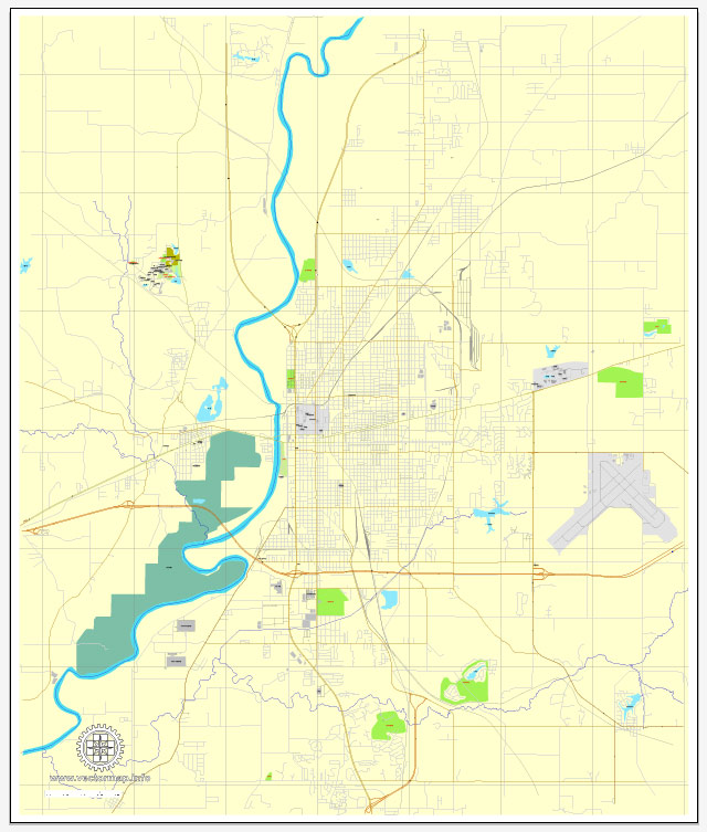
A general overview of Terre Haute, Indiana.
Vectormap.Net provide you with the most accurate and up-to-date vector maps in Adobe Illustrator, PDF and other formats, designed for editing and printing. Please read the vector map descriptions carefully.
Terre Haute Overview: Terre Haute is a city located in western Indiana, United States. It serves as the county seat of Vigo County and is situated along the Wabash River. Terre Haute has a rich history and is known for its industrial, educational, and cultural significance.
Districts and Communities:
- Downtown Terre Haute: This area is the heart of the city and is characterized by a mix of commercial, residential, and government buildings. Downtown Terre Haute features a variety of shops, restaurants, and cultural venues.
- Farrington Grove: This is a historic residential neighborhood known for its charming homes and tree-lined streets. It has a mix of architectural styles, including Victorian and Colonial Revival.
- Collett Park: This district is home to Collett Park, a public park with walking paths, a playground, and green spaces. The surrounding residential area is known for its historic homes.
- Indiana State University Area: Terre Haute is home to Indiana State University, and the area around the campus is vibrant with student life. This district includes student housing, academic buildings, and recreational facilities.
- Hulman Street Historic District: This area is known for its well-preserved historic homes and is listed on the National Register of Historic Places. It’s a residential district with a rich architectural heritage.
- Fruitridge Avenue Historic District: Another historic district with a focus on preserving the architectural history of the city. It features homes with unique designs and styles.
Main Streets:
- Wabash Avenue: This is one of the primary commercial streets in Terre Haute, running through downtown and hosting various shops, restaurants, and businesses.
- Ohio Street: Connecting downtown with the Indiana State University campus, Ohio Street is a notable thoroughfare in the city.
- Poplar Street: Running through several residential neighborhoods, Poplar Street is known for its historic homes and provides access to parks and schools.
- Third Street: Located in downtown Terre Haute, Third Street is home to various businesses, restaurants, and cultural institutions.
Notable Locations:
- Indiana State University: A major public university located in Terre Haute, offering a range of academic programs.
- Terre Haute Children’s Museum: A family-friendly attraction featuring interactive exhibits and educational programs.
- Clabber Girl Museum: Showcasing the history of the Clabber Girl baking powder company, a significant part of Terre Haute’s industrial heritage.


 Author: Kirill Shrayber, Ph.D. FRGS