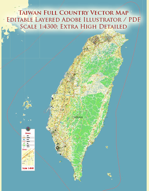
Taiwan is an island nation located in East Asia, and it is officially known as the Republic of China (ROC).
Vectormap.Net provide you with the most accurate and up-to-date vector maps in Adobe Illustrator, PDF and other formats, designed for editing and printing. Please read the vector map descriptions carefully.
The following is a detailed description of some of the main cities, ports, towns, and principal roads in Taiwan:
Cities:
- Taipei:
- Description: The capital and largest city of Taiwan, located in the northern part of the island. Taipei is a political, economic, and cultural hub, known for its modern skyscrapers, vibrant night markets, and cultural attractions like the National Palace Museum.
- Kaohsiung:
- Description: Situated in the southern part of Taiwan, Kaohsiung is the second-largest city and a major port. It is an industrial city with a busy harbor, and it boasts attractions like the Love River, Lotus Pond, and the Dragon and Tiger Pagodas.
- Taichung:
- Description: Located in central Taiwan, Taichung is the third-largest city. It is known for its parks, museums, and cultural sites. The Feng Chia Night Market is a popular spot for local cuisine and shopping.
- Tainan:
- Description: Tainan is one of the oldest cities in Taiwan and served as the island’s capital during imperial times. It is rich in history and culture, featuring ancient temples, forts, and traditional Taiwanese architecture.
Ports:
- Keelung Port:
- Description: Located in northern Taiwan, Keelung Port is a major cargo and passenger port. It serves as an important gateway for international trade and tourism.
- Kaohsiung Port:
- Description: Situated in southern Taiwan, Kaohsiung Port is the largest and busiest port in the country. It plays a crucial role in Taiwan’s global trade and is known for its container terminals and shipbuilding industry.
- Taichung Port:
- Description: Taichung Port is a multi-functional port located in central Taiwan. It handles both cargo and passenger traffic, contributing to the region’s economic development.
Towns and Principal Roads:
- Hsinchu:
- Description: Hsinchu is a city in northern Taiwan known for its technology industry, including the Hsinchu Science Park. It is connected by various roads and highways, making it accessible from different parts of the island.
- Yilan:
- Description: Yilan is a county and town on the northeastern coast of Taiwan. It is known for its scenic landscapes, hot springs, and outdoor activities. The Yilan-Taipei Highway connects Yilan to the capital city.
- Highway System:
- Taiwan has an extensive network of highways connecting major cities and towns. The National Freeway system (National Highways) plays a crucial role in transportation, with major routes connecting Taipei, Taichung, and Kaohsiung.
- East Coast Scenic Area:
- The East Coast of Taiwan is known for its picturesque landscapes, and the Suhua Highway (Provincial Highway No. 9) runs along this coast, offering stunning views of the Pacific Ocean.
It’s important to note that Taiwan has a well-developed transportation infrastructure, including high-speed rail, railways, and an extensive bus network, making it relatively easy to travel within the island. Additionally, Taiwan’s geography is characterized by mountainous terrain, providing opportunities for outdoor activities and scenic drives.


 Author: Kirill Shrayber, Ph.D.