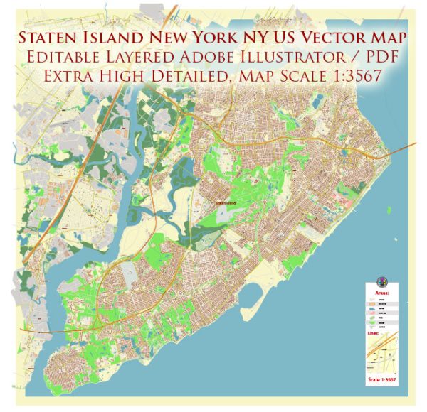
A general overview of Staten Island, including information about its port, canals, main streets, and roads.
Vectormap.Net provide you with the most accurate and up-to-date vector maps in Adobe Illustrator, PDF and other formats, designed for editing and printing. Please read the vector map descriptions carefully.
- Port: Staten Island has a significant maritime presence, but it does not have a major commercial port like those found in other boroughs of New York City. The most notable maritime facility is the Howland Hook Marine Terminal, operated by the Port Authority of New York and New Jersey. It handles containerized cargo and plays a role in the region’s shipping and logistics.
- Canals: Staten Island is not extensively crisscrossed by canals like some other cities, and its waterways are primarily natural, such as the Arthur Kill and the Kill Van Kull. These bodies of water have historically been important for maritime activities and trade.
- Main Streets and Roads:
- Hylan Boulevard: One of the longest and most prominent roads on Staten Island, running from the Verrazzano-Narrows Bridge in the north to Tottenville in the south. It passes through various neighborhoods and commercial areas.
- Richmond Avenue: A major north-south thoroughfare that traverses the center of the island, connecting communities and commercial districts.
- Victory Boulevard: Another important east-west road, connecting the eastern and western parts of Staten Island. It is known for its diverse range of businesses and services.
- Staten Island Expressway (I-278): This highway connects Staten Island to Brooklyn via the Verrazzano-Narrows Bridge. It’s a vital transportation link for commuters traveling between Staten Island and other parts of New York City.
- West Shore Expressway (NY-440): Running along the western side of the island, this highway provides a route for north-south travel.
- Huguenot Avenue, Amboy Road, and Arthur Kill Road: These are examples of roads that serve various neighborhoods on Staten Island, providing local access and connecting to larger arteries.
- Forest Avenue: Running through the northern part of the island, Forest Avenue is a significant road with commercial establishments and residential areas.
- Arthur Kill Road: Connecting the eastern and western parts of the island, this road passes through different neighborhoods and is an important local route.
It’s important to check for updates and changes, as infrastructure and road layouts may evolve over time. Additionally, consult local maps and resources for the most accurate and current information on Staten Island’s port facilities, canals, streets, and roads.


 Author: Kirill Shrayber, Ph.D. FRGS