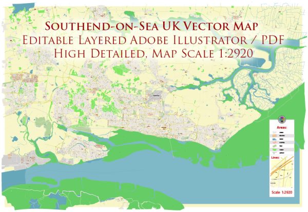
Southend-on-Sea is a coastal town located in Essex, England, with a rich history and a well-developed transportation infrastructure.
Vectormap.Net provide you with the most accurate and up-to-date vector maps in Adobe Illustrator, PDF and other formats, designed for editing and printing. Please read the vector map descriptions carefully.
Let’s explore its history, port, and transportation systems in more detail:
History:
- Early History: Southend’s history dates back to the medieval period when it was a small fishing village. The town’s name is derived from the Old English words “sūth” and “ende,” meaning south and end, respectively.
- 19th Century Expansion: The 19th century saw significant growth with the development of the seaside resort. The arrival of the railway in 1889 played a crucial role in attracting tourists and fostering economic development.
- Aviation History: Southend played a role in aviation history, serving as the location of the first air-passage in 1910. London Southend Airport has a history dating back to the First World War when it was used as an airbase.
Port:
- Historical Importance: Southend-on-Sea historically had a small port that served as a fishing and trade hub. While not as prominent as larger ports in the UK, it contributed to the town’s economic development.
- Current Port Status: The modern port of Southend-on-Sea is not a major cargo port but has facilities for handling general cargo and bulk materials. It plays a role in supporting local industries and businesses.
Transportation Infrastructure:
- Railway: The railway has been a vital part of Southend’s transportation network since the late 19th century. Southend Victoria and Southend Central are two major railway stations connecting the town to London and other parts of Essex.
- Road Network: Southend is well-connected by road, with the A127 and A13 being major arterial routes. The road network facilitates easy access to London and other neighboring towns.
- London Southend Airport: London Southend Airport, located to the northeast of the town, has grown in importance. It serves as a regional airport, offering flights to various destinations in Europe. The airport has undergone expansions and improvements to enhance its capacity and services.
- Local Transportation: Southend has a comprehensive local transportation system, including buses and taxis, providing convenient intra-town travel for residents and visitors.
- Pedestrianization: In recent years, there have been efforts to enhance the town’s walkability, with pedestrianized areas, cycling paths, and improved public spaces.
Conclusion:
Southend-on-Sea’s history reflects its evolution from a small fishing village to a thriving seaside resort town. While its port is not a major player in the shipping industry, the town boasts a well-developed transportation infrastructure, with strong rail and road connections and a growing regional airport, contributing to its accessibility and economic vitality.


 Author: Kirill Shrayber, Ph.D.