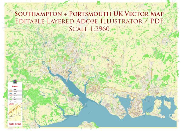
A detailed description of the port, main streets and roads of the Southampton + Portsmouth UK
Vectormap.Net provide you with the most accurate and up-to-date vector maps in Adobe Illustrator, PDF and other formats, designed for editing and printing. Please read the vector map descriptions carefully.
Southampton:
Port of Southampton:
The Port of Southampton is one of the largest and busiest ports in the UK. It has multiple terminals, including the Eastern Docks, Western Docks, and the container terminal. The port serves as a major gateway for cruise ships, cargo vessels, and ferries. The Eastern Docks primarily handle cruise ships, while the Western Docks handle cargo and container traffic.
Main Streets and Roads:
- High Street: This is one of the main shopping streets in Southampton, lined with shops, restaurants, and cafes. It connects Bargate (the medieval gatehouse) to the QE2 Mile, a pedestrianized area.
- The Avenue: A major road that runs through the center of Southampton, lined with parks, gardens, and residential areas.
- West Quay Road: Leading to the West Quay Shopping Centre, this road is a significant route for shoppers and connects to the M271 motorway.
- Ocean Village: A waterfront area with restaurants, bars, and residential buildings. It’s a popular spot for leisure and entertainment.
- Itchen Bridge: A toll bridge that spans the River Itchen, connecting the eastern and western parts of Southampton.
Portsmouth:
Port of Portsmouth:
The Port of Portsmouth is known for its historic naval significance. It is home to the Royal Navy and has ferry terminals connecting to France, Spain, and the Isle of Wight.
Main Streets and Roads:
- Commercial Road: This is a major shopping street in the city, housing a variety of retail stores, restaurants, and entertainment venues.
- Gosport Ferry: Connecting Portsmouth to Gosport, this ferry provides an essential transportation link across Portsmouth Harbour.
- Clarence Pier: A popular amusement pier located on South Parade, offering attractions and amusements with views of the Solent.
- Portsea Island: The main island where Portsmouth is situated, connected to the mainland by several road bridges.
- M275 Motorway: Providing a direct link to the M27 motorway, this road is crucial for traffic moving in and out of Portsmouth.
Both Southampton and Portsmouth have rich maritime histories and offer a mix of historical sites, cultural attractions, and vibrant commercial areas.


 Author: Kirill Shrayber, Ph.D.