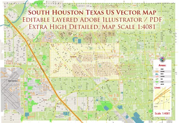
South Houston, Texas, is a vibrant city with a rich tapestry of infrastructure, including ports, canals, main streets, and roads. While South Houston itself is not directly on the coast, it is part of the greater Houston metropolitan area, which boasts one of the busiest ports in the United States, the Port of Houston.
Vectormap.Net provide you with the most accurate and up-to-date vector maps in Adobe Illustrator, PDF and other formats, designed for editing and printing. Please read the vector map descriptions carefully.
Here’s a detailed description of each:
Port of Houston:
The Port of Houston is a sprawling complex situated along the Houston Ship Channel, which connects the port to the Gulf of Mexico. It’s a vital economic hub, handling a diverse range of cargo, including containerized goods, petroleum products, chemicals, and more. The port features an extensive network of docks, terminals, and warehouses, facilitating the seamless movement of goods in and out of the region. Additionally, the Port of Houston plays a crucial role in global trade, serving as a gateway for imports and exports to and from the United States.
Canals:
While South Houston itself might not have extensive canals, the broader Houston area has a network of waterways, including the Houston Ship Channel and various other channels and bayous. These waterways serve multiple purposes, including transportation, flood control, and recreation. Canals in the region often intersect with major roadways and industrial areas, providing a means for shipping and navigation within the city and beyond.
Main Streets and Roads:
South Houston is well-connected by a network of main streets and roads that facilitate transportation within the city and to other parts of the Houston metropolitan area. Some of the prominent thoroughfares include:
- Interstate 45 (Gulf Freeway): Running north-south, Interstate 45 is a major artery that connects South Houston to downtown Houston and other cities in the region. It’s a crucial route for commuters and freight traffic alike.
- Texas State Highway 3 (Galveston Road): Galveston Road is a significant north-south route that traverses South Houston, linking it to neighboring communities and providing access to points south, including the city of Galveston.
- Spencer Highway: This east-west thoroughfare is an important commercial corridor in South Houston, lined with businesses, shops, and restaurants. It connects the city to nearby areas and intersects with other key routes.
- Pasadena Freeway (State Highway 225): While not directly passing through South Houston, State Highway 225 is nearby and serves as a vital transportation link, connecting the region to the Port of Houston and various industrial areas.
- Old Galveston Road: Another significant north-south artery, Old Galveston Road runs parallel to Highway 3, providing additional access to South Houston and surrounding areas.
These main streets and roads form the backbone of South Houston’s transportation infrastructure, facilitating the movement of people and goods throughout the city and beyond. They play a critical role in supporting the region’s economy and fostering connectivity between different communities.


 Author: Kirill Shrayber, Ph.D.