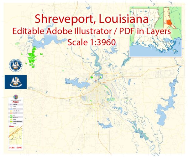
A general overview of the port, main streets, and roads in Shreveport and Bossier, Louisiana.
Vectormap.Net provide you with the most accurate and up-to-date vector maps in Adobe Illustrator, PDF and other formats, designed for editing and printing. Please read the vector map descriptions carefully.
Shreveport:
- Port of Shreveport-Bossier:
- The Port of Shreveport-Bossier is a riverport located along the Red River.
- It facilitates the transportation of goods via waterways and is an essential component of the region’s logistics and trade infrastructure.
- Main Streets:
- Texas Street: Texas Street is one of the main thoroughfares in downtown Shreveport, hosting various shops, restaurants, and businesses. It’s a historical street with a mix of architecture.
- Clyde Fant Parkway: This parkway runs along the Red River and offers scenic views. It’s a popular route for recreational activities and events.
- Youree Drive: A major commercial corridor with shopping centers, restaurants, and other businesses.
- Major Roads:
- Interstate 20 (I-20): A major east-west highway passing through Shreveport, connecting it with cities like Dallas and Jackson.
- Interstate 49 (I-49): A north-south highway that intersects with I-20 in Shreveport and provides access to destinations like Alexandria and Lafayette.
- Bert Kouns Industrial Loop: A loop road providing access to various industrial and commercial areas in Shreveport.
Bossier:
- Barksdale Air Force Base:
- Barksdale AFB is located in Bossier City and is a significant military installation. It has various entry points and is an integral part of the community.
- Main Streets:
- Barksdale Boulevard: This is a prominent road in Bossier City, hosting a variety of businesses and leading to the Barksdale AFB gate.
- Airline Drive: A major thoroughfare with shopping centers, restaurants, and access to various neighborhoods.
- East Texas Street: Another important street with commercial and residential areas.
- Major Roads:
- I-20: Like in Shreveport, Interstate 20 runs through Bossier City, providing a crucial east-west transportation route.
- I-220: This interstate loop connects with I-20 and I-49, providing access to different parts of the city.
- Traffic Street: A road that runs parallel to the Red River and provides access to various neighborhoods and businesses.
It’s essential to note that cityscapes can change, and new developments may have occurred since my last update. For the most accurate and up-to-date information, consider checking local maps, official city websites, or contacting local authorities.


 Author: Kirill Shrayber, Ph.D.