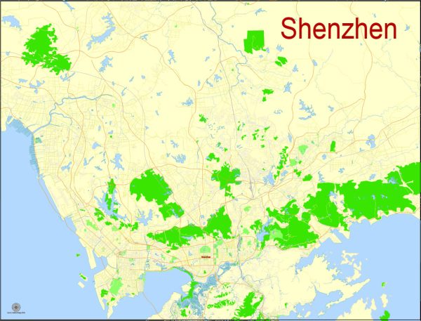
A general overview of Shenzhen, including its port, canals, and main streets and roads.
Vectormap.Net provide you with the most accurate and up-to-date vector maps in Adobe Illustrator, PDF and other formats, designed for editing and printing. Please read the vector map descriptions carefully.
- Port of Shenzhen:
- The Port of Shenzhen is one of the busiest and largest container ports in the world. It is located in the Pearl River Delta in southern China.
- There are several port areas within Shenzhen, including Yantian Port, Shekou Port, Chiwan Port, and others.
- Yantian Port is known for its container terminals, handling a significant portion of Shenzhen’s container traffic.
- Canals:
- Shenzhen has an extensive network of rivers, lakes, and canals, including the Shenzhen River and several smaller waterways.
- The Shenzhen River serves as a natural border between Shenzhen and Hong Kong. It plays a vital role in transportation and trade.
- Main Streets and Roads:
- Shennan Road (深南大道): Shennan Road is one of the main thoroughfares in Shenzhen, running from east to west across the city. It is a major commercial and financial district with numerous skyscrapers and business centers.
- Nanshan Avenue (南山大道): Located in the Nanshan District, this avenue is known for its vibrant commercial areas and proximity to key technology and innovation zones.
- Binhe Avenue (滨河大道): This road runs along the Shenzhen River, offering scenic views and connecting various districts.
- Futian Road (福田路): Located in the Futian District, this road is part of the central business district and is home to many government offices, commercial centers, and high-rise buildings.
- Dongmen Pedestrian Street (东门步行街): A popular shopping district, Dongmen Pedestrian Street is known for its bustling markets, shops, and restaurants.
- Landmarks:
- Shenzhen Civic Center: A prominent landmark in the Futian District, it includes government buildings, the Shenzhen Concert Hall, and the Shenzhen Library.
- Huaqiangbei Commercial Street: Famous for electronics markets, Huaqiangbei is a bustling area for gadget enthusiasts and those looking for electronic components.
Please note that Shenzhen is a rapidly developing city, and there may have been changes or additions to its infrastructure since my last update. For the latest and most accurate information, it’s recommended to consult recent maps, guides, or local authorities.


 Author: Kirill Shrayber, Ph.D. FRGS