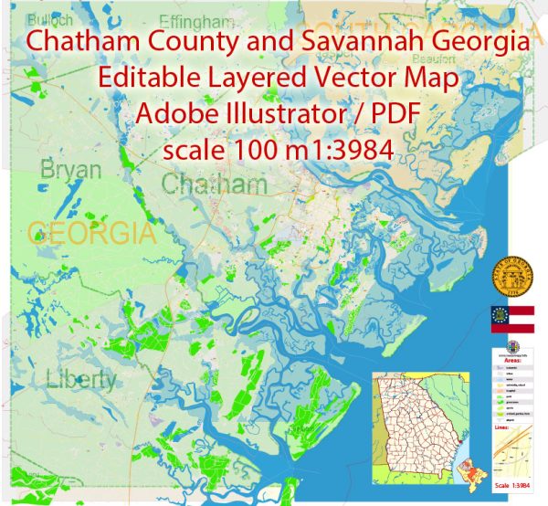
Savannah and Chatham County in Georgia have a rich industrial history, with a focus on commerce, trade, and transportation. The city of Savannah, one of the oldest cities in the United States, played a pivotal role in the development of the region.
Vectormap.Net provide you with the most accurate and up-to-date vector maps in Adobe Illustrator, PDF and other formats, designed for editing and printing. Please read the vector map descriptions carefully.
Here’s a detailed description of the industrial history, port, and road system in Savannah and Chatham County:
Industrial History:
- Colonial Era:
- Savannah was established in 1733 by General James Oglethorpe and was the first colonial capital of Georgia.
- Initially, the economy was based on agriculture, with rice and indigo being major crops.
- Cotton Industry:
- In the 19th century, the cotton industry became dominant in the region, and Savannah emerged as a key player in the cotton trade.
- The introduction of the cotton gin in the early 1800s further boosted cotton production and export.
- Railroads and Expansion:
- The mid-19th century saw the expansion of railroads, connecting Savannah to other parts of Georgia and the interior of the United States.
- Railroads facilitated the transportation of goods, and Savannah became a major hub for both imports and exports.
- Port of Savannah:
- The Port of Savannah was officially established in 1744, making it one of the oldest ports in the United States.
- Over the years, the port grew in significance, handling a diverse range of cargoes, including agricultural products, timber, and later, containerized goods.
Port of Savannah:
- Modernization:
- In the latter half of the 20th century, the Port of Savannah underwent significant modernization efforts.
- The development of containerization in the 1950s and 1960s transformed the shipping industry, and Savannah adapted to accommodate containerized cargo.
- Container Terminal:
- The Garden City Terminal, one of the largest single-terminal container facilities in North America, was opened in 2007.
- The port has deepened its channels to accommodate larger vessels, increasing its capacity and global competitiveness.
- Economic Impact:
- The Port of Savannah is a major economic driver for the region and the state of Georgia.
- It supports a wide range of industries, including manufacturing, distribution, and logistics.
Road System:
- Highways:
- Savannah is well-connected by a network of highways, including I-16, I-95, and I-516, facilitating the movement of goods and people.
- Infrastructure Development:
- Ongoing infrastructure development projects focus on improving road networks to support the increasing traffic associated with the port and industrial activities.
- Intermodal Connectivity:
- Efforts have been made to enhance intermodal connectivity, integrating road, rail, and port facilities to streamline the transportation of goods.
- Logistics and Distribution Centers:
- The strategic location of Savannah, with its efficient road system, has attracted the establishment of logistics and distribution centers, further contributing to the economic vitality of the region.
In summary, Savannah and Chatham County have a diverse and dynamic industrial history, with a strong focus on trade, shipping, and transportation. The Port of Savannah and its associated road systems play a crucial role in supporting the economic development and global connectivity of the region.


 Author: Kirill Shrayber, Ph.D.