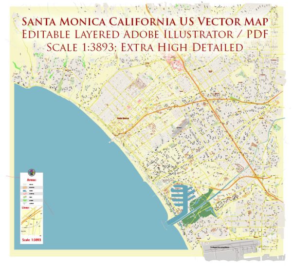
Santa Monica is a coastal city located in western Los Angeles County, California, known for its beautiful beaches, vibrant culture, and iconic pier. The city is characterized by a variety of districts, communities, and main streets that offer a diverse range of experiences.
Vectormap.Net provide you with the most accurate and up-to-date vector maps in Adobe Illustrator, PDF and other formats, designed for editing and printing. Please read the vector map descriptions carefully.
Here’s a general overview:
- Downtown Santa Monica:
- Third Street Promenade: This pedestrian-only shopping street is a major attraction, featuring a wide array of retail stores, restaurants, and entertainment venues.
- Santa Monica Place: A high-end shopping mall adjacent to the Third Street Promenade, offering luxury brands and dining options.
- Santa Monica Pier: An iconic landmark with an amusement park, aquarium, and family-friendly attractions. The pier also hosts events and performances.
- Main Street:
- Running parallel to the beach, Main Street is known for its eclectic mix of boutiques, cafes, and restaurants.
- Main Street Farmer’s Market: Held on Sundays, this market offers fresh produce, artisanal goods, and a lively atmosphere.
- Ocean Park:
- This neighborhood is situated south of the Santa Monica Pier and is known for its residential charm. It has a mix of historic homes, trendy boutiques, and cafes.
- Montana Avenue:
- A upscale shopping district, Montana Avenue is lined with boutique shops, galleries, and fine dining establishments. It has a more relaxed and suburban atmosphere compared to downtown.
- Mid-City:
- This area is a mix of residential and commercial spaces. It offers a diverse range of restaurants and shops catering to both locals and visitors.
- Wilshire/Montana:
- A residential neighborhood featuring a blend of single-family homes and apartments. It’s known for its tree-lined streets and proximity to both Montana Avenue and Wilshire Boulevard.
- Pico Neighborhood:
- A diverse residential area with a mix of housing types. Pico Boulevard runs through this neighborhood, offering various shopping and dining options.
- Wilshire Boulevard:
- A major thoroughfare that extends into Santa Monica, lined with businesses, restaurants, and offices. It connects Santa Monica to neighborhoods in Los Angeles.
- North of Montana:
- An affluent residential area featuring large, upscale homes. It is a sought-after neighborhood known for its exclusivity.
These descriptions provide a broad overview of the various districts and communities in Santa Monica. Keep in mind that the city’s dynamic nature means that new developments and changes may occur over time.


 Author: Kirill Shrayber, Ph.D. FRGS