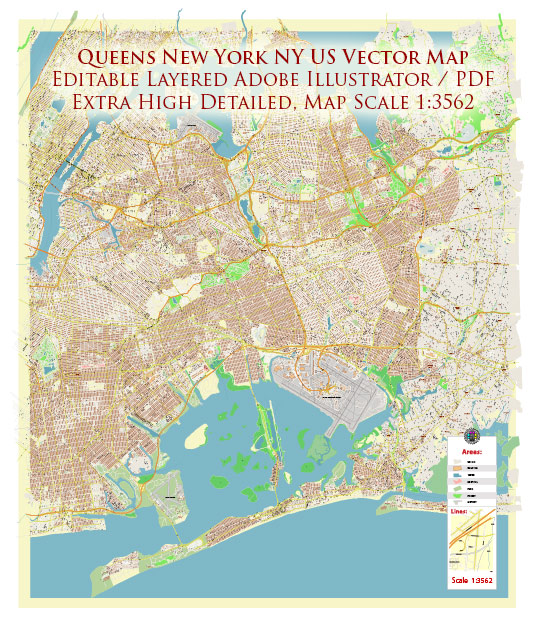
A general overview of the roads and streets infrastructure in Queens, New York City.
Vectormap.Net provide you with the most accurate and up-to-date vector maps in Adobe Illustrator, PDF and other formats, designed for editing and printing. Please read the vector map descriptions carefully.
1. Grid System: Queens, like much of New York City, follows a grid system. Streets generally run east-west, while avenues run north-south. The borough is divided into neighborhoods, each with its own distinct character and layout.
2. Major Highways: Queens is well-connected to other boroughs and regions through a network of highways and expressways. Some of the major ones include:
- Long Island Expressway (I-495): A key east-west route connecting Queens to Long Island.
- Grand Central Parkway: Connecting the Triborough Bridge to the Queens-Midtown Tunnel and passing through Flushing Meadows-Corona Park.
- Van Wyck Expressway (I-678): Running north-south and connecting Queens to JFK International Airport.
3. Bridges and Tunnels: Queens is linked to other boroughs via several bridges and tunnels:
- Queensboro Bridge (59th Street Bridge): Connecting Long Island City to Manhattan.
- Triborough Bridge (Robert F. Kennedy Bridge): Linking Astoria to Manhattan, the Bronx, and Randall’s Island.
- Queens-Midtown Tunnel: Connecting Midtown Manhattan and Long Island City.
- Throgs Neck Bridge: Connecting Queens to the Bronx over the East River.
4. Neighborhood Streets: Queens is made up of various neighborhoods, each with its own set of local streets. Notable neighborhoods include Astoria, Flushing, Jamaica, Forest Hills, and Jackson Heights. These neighborhoods have a mix of residential, commercial, and industrial zones, each with its own street layout.
5. Public Transportation: Queens has an extensive public transportation system, including subway lines (such as the 7, E, F, M, and R trains), buses, and the Long Island Rail Road (LIRR). The subway system provides a crucial link between Queens and Manhattan, while buses serve local routes within the borough.
6. Parks and Open Spaces: Queens features several parks and green spaces, influencing the road layout. Flushing Meadows-Corona Park, one of the largest parks in the city, has a significant impact on the road network around it.
7. Commercial and Industrial Areas: Queens has various commercial and industrial zones, leading to a mix of wide boulevards, smaller streets, and industrial areas with warehouses and factories.
8. Ongoing Developments: Infrastructure in New York City is subject to ongoing development and improvement projects. For the latest and most accurate information, it’s recommended to check with local city planning authorities or updated sources.


 Author: Kirill Shrayber, Ph.D.