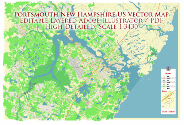
Portsmouth, located in the state of New Hampshire, United States, has a rich history, a notable port, and a diverse transportation infrastructure.
Vectormap.Net provide you with the most accurate and up-to-date vector maps in Adobe Illustrator, PDF and other formats, designed for editing and printing. Please read the vector map descriptions carefully.
Here is a detailed description:
History:
- Colonial Era: Portsmouth has a deep colonial history, dating back to the early 17th century. It was settled in 1623, making it one of the oldest cities in the United States. The city played a crucial role in early trade and maritime activities.
- Revolutionary War: During the American Revolution, Portsmouth was a significant hub for shipbuilding and served as a key port for privateers. The USS Raleigh, one of the first 13 warships commissioned by the Continental Congress, was built in Portsmouth.
- 19th Century: Portsmouth continued to be an important maritime center in the 19th century. The city’s Strawberry Banke Museum preserves and showcases its historic architecture, providing a glimpse into life in the 17th to 19th centuries.
- 20th Century to Present: Portsmouth evolved into a cultural and economic center in the 20th century. The city’s historic charm, preserved architecture, and proximity to the coast contribute to its popularity as a tourist destination.
Port:
- Port of New Hampshire: The Port of New Hampshire in Portsmouth is a small but vital port facility along the Piscataqua River. It handles general cargo, bulk cargo, and project cargo. The port’s location makes it an essential gateway for goods entering and leaving the region.
- Maritime Heritage: Portsmouth’s maritime heritage is evident in its historic waterfront, where visitors can see old warehouses, shipyards, and piers. The city’s commitment to preserving its maritime history contributes to its unique character.
Transportation Infrastructure:
- Roads: Portsmouth is well-connected by road. Interstate 95 passes through the city, linking it to major cities in the region, including Boston to the south and Portland, Maine, to the north. The city has a well-maintained road network that facilitates local and regional travel.
- Bridges: The Piscataqua River is spanned by several bridges, including the Memorial Bridge, the Sarah Mildred Long Bridge, and the Piscataqua River Bridge. These bridges play a crucial role in connecting Portsmouth with neighboring areas in Maine and facilitating regional transportation.
- Public Transportation: Portsmouth has a public transportation system that includes buses and trolleys, providing convenient options for residents and visitors to navigate the city.
- Airports: While Portsmouth itself does not have a major airport, Portsmouth International Airport at Pease, located a few miles west of the city, serves the region. The airport offers commercial flights and contributes to the area’s air transportation infrastructure.
In summary, Portsmouth’s history as a colonial settlement, its maritime heritage, and its well-connected transportation infrastructure make it a unique and historically significant city on the New England coast. The port and transportation facilities play a crucial role in supporting the city’s economic activities and maintaining its status as a vibrant community.


 Author: Kirill Shrayber, Ph.D.