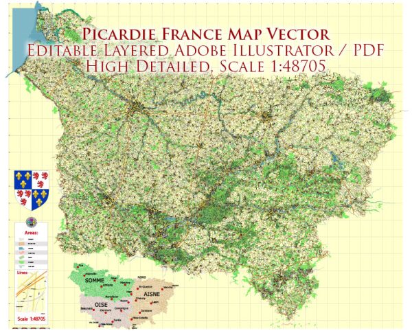
Picardy (Picardie in French) is a historical region located in the northern part of France. It was merged into the larger administrative region of Hauts-de-France in 2016.
Vectormap.Net provide you with the most accurate and up-to-date vector maps in Adobe Illustrator, PDF and other formats, designed for editing and printing. Please read the vector map descriptions carefully.
Here is a general overview of some of the main cities and towns, as well as principal roads, in the Picardy region:
Main Cities and Towns:
- Amiens:
- Amiens is the capital and largest city of the Picardy region.
- The city is known for its stunning Gothic cathedral, the Cathédrale Notre-Dame d’Amiens, which is a UNESCO World Heritage site.
- Amiens also has a rich cultural heritage, including the floating gardens (Hortillonnages) and the Maison de Jules Verne, where the famous author lived.
- Beauvais:
- Beauvais is known for its Gothic cathedral, the Cathédrale Saint-Pierre de Beauvais, which boasts the highest choir in the world.
- The city has a historical center with charming streets and squares.
- Compiègne:
- Compiègne is famous for its historical significance, including being the site of the signing of the Armistice in 1918, ending World War I.
- The city has a royal palace, the Château de Compiègne, which served as a residence for French monarchs.
- Saint-Quentin:
- Saint-Quentin is an industrial city known for its Art Deco architecture.
- The Basilica of Saint-Quentin is a major religious and architectural landmark in the city.
Principal Roads:
- A1 Autoroute:
- The A1 is a major north-south highway that connects Paris to Lille and passes through Picardy.
- It is a crucial route for transportation between the capital and northern France.
- A16 Autoroute:
- The A16 is an important east-west highway that connects the cities of Amiens and Calais.
- It plays a significant role in connecting Picardy to the English Channel and the Eurotunnel.
- N25/N31:
- The N25 and N31 are national roads that traverse Picardy, connecting various towns and cities.
- D Roads (Departmental Roads):
- The D roads are local roads maintained by the departments within Picardy, providing connectivity to smaller towns and villages.
Please note that infrastructure and road networks can change over time, so it’s advisable to check for the latest information from local sources or official maps for the most up-to-date details on cities, towns, and roads in the Picardy region.


 Author: Kirill Shrayber, Ph.D.