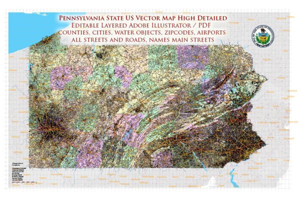
Pennsylvania is a diverse state with a mix of urban and rural areas, and it is known for its rich history and varied landscapes.
Vectormap.Net provide you with the most accurate and up-to-date vector maps in Adobe Illustrator, PDF and other formats, designed for editing and printing. Please read the vector map descriptions carefully.
Here’s a detailed overview of some of the main cities, towns, and roads in Pennsylvania:
Major Cities:
- Philadelphia:
- Philadelphia is the largest city in Pennsylvania and is known for its rich history, cultural attractions, and vibrant arts scene.
- Key attractions include Independence Hall, Liberty Bell, Philadelphia Museum of Art, and the iconic “Rocky Steps.”
- Pittsburgh:
- Pittsburgh, located in the western part of the state, is known for its steel industry heritage and is now a hub for technology and healthcare.
- The city features attractions such as the Andy Warhol Museum, Carnegie Museum of Natural History, and Point State Park.
- Harrisburg:
- Harrisburg serves as the capital of Pennsylvania and is centrally located along the Susquehanna River.
- The Pennsylvania State Capitol building is a prominent landmark, and the city has several museums and historic sites.
- Allentown:
- Allentown is located in the Lehigh Valley and is known for its industrial history.
- Attractions include the Allentown Art Museum, America on Wheels Museum, and the Lehigh Valley Heritage Museum.
- Erie:
- Erie is situated along the shores of Lake Erie and is known for its maritime history and outdoor activities.
- Presque Isle State Park, Erie Maritime Museum, and the Erie Zoo are popular attractions.
Major Towns:
- State College:
- Home to Pennsylvania State University (Penn State), State College has a lively college town atmosphere.
- Beaver Stadium hosts major football games, and the town offers cultural events and outdoor activities.
- Lancaster:
- Lancaster is known for its Amish community and is often associated with traditional farming and crafts.
- The Amish Farm and House, Lancaster Central Market, and Dutch Wonderland are notable places.
- Scranton:
- Scranton has a strong industrial history and is known for its coal mining heritage.
- Attractions include Steamtown National Historic Site, Lackawanna Coal Mine Tour, and the Electric City Trolley Museum.
- Reading:
- Reading is situated in southeastern Pennsylvania and has a mix of urban and rural areas.
- The Reading Public Museum, Daniel Boone Homestead, and the Pagoda are among the attractions.
Roads:
- Interstate Highways:
- I-76 (Pennsylvania Turnpike): Crosses the state from the Ohio border to the New Jersey border.
- I-80: Connects the western and eastern parts of the state, passing through cities like Erie, State College, and Stroudsburg.
- I-95: Runs along the eastern border, connecting Philadelphia to other major cities on the East Coast.
- Toll Roads:
- The Pennsylvania Turnpike is a major toll road system in the state, connecting various cities and regions.
- Free Roads:
- Various state and U.S. routes, such as U.S. Route 22, U.S. Route 30, and U.S. Route 322, provide free alternatives to the toll roads.
Pennsylvania’s road network is extensive, offering a mix of highways, interstates, and scenic routes that connect its diverse cities, towns, and rural areas. The state’s transportation infrastructure plays a crucial role in facilitating travel and commerce throughout the region.


 Author: Kirill Shrayber, Ph.D. FRGS