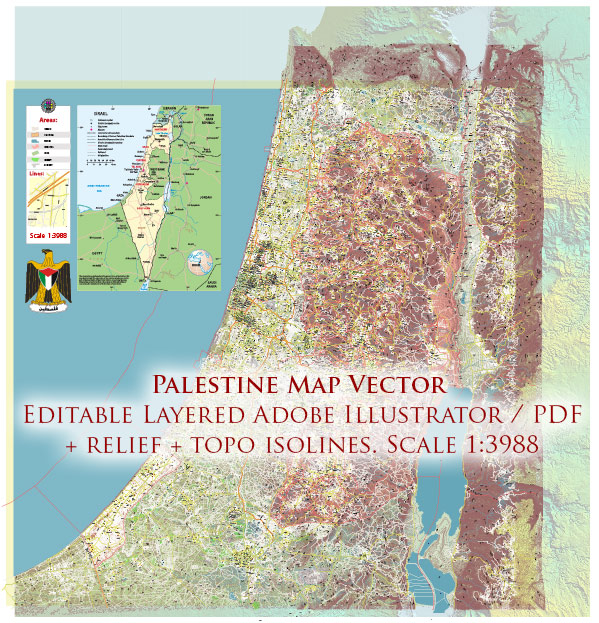
The political and transportation history of Palestine is complex and deeply intertwined with regional conflicts and geopolitical developments. The area known as Palestine has a rich history that spans thousands of years, and its political and transportation dynamics have evolved significantly over time.
Vectormap.Net provide you with the most accurate and up-to-date vector maps in Adobe Illustrator, PDF and other formats, designed for editing and printing. Please read the vector map descriptions carefully.
Here’s a broad overview of these aspects:
Political History:
- Ancient Periods:
- Palestine has a long history dating back to ancient times, with civilizations such as the Canaanites, Israelites, and Philistines inhabiting the region.
- The area witnessed the rise and fall of various empires, including the Egyptian, Assyrian, Babylonian, Persian, and Hellenistic empires.
- Roman and Byzantine Rule:
- Palestine came under Roman rule in the 1st century BCE. Jerusalem became a focal point of religious significance.
- After the split of the Roman Empire, Palestine was part of the Eastern Roman (Byzantine) Empire.
- Islamic Caliphates:
- In the 7th century, the Islamic Caliphates, particularly the Umayyad and Abbasid Caliphates, controlled the region.
- Crusader Period:
- The Crusaders established their presence in the region during the 11th to 13th centuries.
- Ottoman Empire:
- From the 16th century until the end of World War I, Palestine was part of the Ottoman Empire.
- British Mandate:
- After World War I, the League of Nations granted Britain the mandate to govern Palestine. This period witnessed tensions between Jewish and Arab communities.
- 1948 Arab-Israeli War:
- The establishment of the State of Israel in 1948 led to the Arab-Israeli conflict. The war resulted in significant territorial changes, with Jordan and Egypt occupying the West Bank and Gaza Strip, respectively.
- Post-1967:
- Israel’s victory in the Six-Day War in 1967 resulted in the occupation of East Jerusalem, the West Bank, and the Gaza Strip.
- Oslo Accords:
- The 1993 Oslo Accords aimed at achieving peace between Israel and the Palestinians, leading to the establishment of the Palestinian Authority in parts of the West Bank and Gaza Strip.
- Contemporary Period:
- Ongoing conflicts, negotiations, and geopolitical tensions continue to shape the political landscape of the region.
Transportation History:
- Ancient Trade Routes:
- Palestine was a crossroads of ancient trade routes, connecting Asia, Africa, and Europe.
- Roman Roads:
- The Romans developed a network of roads, including the Via Maris, connecting Egypt to Syria through Palestine.
- Ottoman Period:
- During Ottoman rule, transportation infrastructure saw limited development, with focus on maintaining existing routes.
- British Mandate:
- The British improved road and rail infrastructure to facilitate control and movement within the mandate.
- Post-1948:
- The 1948 Arab-Israeli War disrupted transportation routes, and subsequent conflicts further impacted infrastructure development.
- Post-1967:
- Israel invested in transportation infrastructure, including roads and checkpoints, which affected the movement of goods and people in the occupied territories.
- Contemporary Period:
- The West Bank and Gaza have faced challenges in developing a cohesive transportation network due to geopolitical factors and restrictions on movement.
The political and transportation history of Palestine is marked by a series of conflicts, foreign interventions, and attempts at peace, shaping the complex reality of the region today. Ongoing efforts are being made to address political and transportation challenges for a more stable and connected future.


 Author: Kirill Shrayber, Ph.D. FRGS