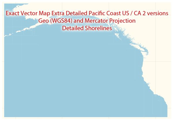
The Pacific Coast of the United States and Canada is home to numerous important ports and harbors, serving as vital gateways for international trade, commerce, and transportation.
Vectormap.Net provide you with the most accurate and up-to-date vector maps in Adobe Illustrator, PDF and other formats, designed for editing and printing. Please read the vector map descriptions carefully.
Here is a detailed overview of some of the principal ports and harbors along the Pacific Coast:
United States:
- Port of Los Angeles (California):
- Description: The Port of Los Angeles is the largest port in the United States and a major gateway for trade with the Pacific Rim. It consists of several container terminals, bulk cargo facilities, and a vast complex of warehouses and distribution centers.
- Port of Long Beach (California):
- Description: Adjacent to the Port of Los Angeles, Long Beach is another significant port on the Pacific Coast. It is the second busiest port in the U.S. and is known for its advanced container facilities, handling a diverse range of goods.
- Port of Seattle (Washington):
- Description: The Port of Seattle is a major seaport and a key hub for trade with Asia. It handles containers, bulk cargo, and has facilities for cruise ships. The port’s strategic location makes it a crucial link for trade with the Pacific Northwest.
- Port of Tacoma (Washington):
- Description: Located in Puget Sound, the Port of Tacoma is a major container port and an important player in the trade network connecting the Pacific Northwest to international markets.
- Port of Oakland (California):
- Description: Situated in the San Francisco Bay Area, the Port of Oakland is a vital gateway for Northern California’s import and export activities. It is a major container port with extensive rail and highway connections.
- Port of San Francisco (California):
- Description: Historically significant, the Port of San Francisco remains a key port for the Bay Area. It primarily handles bulk cargo, break-bulk cargo, and has facilities for passenger cruise ships.
Canada:
- Port of Vancouver (British Columbia):
- Description: The Port of Vancouver is Canada’s largest and most diversified port, handling a wide range of cargo including containers, bulk, and break-bulk. It serves as a major gateway for trade between Canada and Asia.
- Port of Prince Rupert (British Columbia):
- Description: Known for its deep natural harbor, the Port of Prince Rupert has experienced significant growth in recent years. It is a key port for container traffic and bulk cargo, particularly for goods destined for the U.S. Midwest.
- Port of Victoria (British Columbia):
- Description: Situated on Vancouver Island, the Port of Victoria is a major gateway for cruise ships and serves as a key terminal for ferry services. It also handles bulk and break-bulk cargo.
- Port of Portland (Oregon):
- Description: The Port of Portland, located along the Columbia and Willamette rivers, is a critical port for the Pacific Northwest. It handles containers, bulk cargo, and has facilities for auto imports and exports.
These ports collectively play a crucial role in facilitating international trade and contribute significantly to the economic development of the Pacific Coast region in both the United States and Canada.


 Author: Kirill Shrayber, Ph.D. FRGS