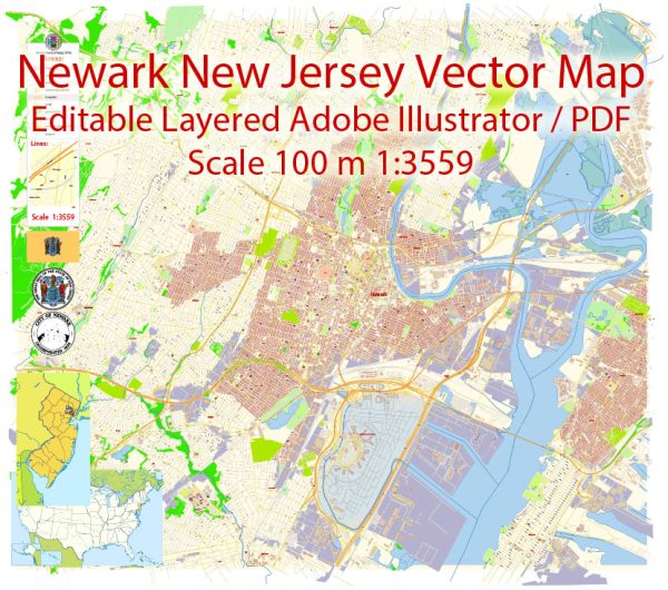
Newark, New Jersey, has a rich industrial history and a well-developed road system that has played a crucial role in the city’s growth and development.
Vectormap.Net provide you with the most accurate and up-to-date vector maps in Adobe Illustrator, PDF and other formats, designed for editing and printing. Please read the vector map descriptions carefully.
Let’s explore both aspects in detail:
Industrial History of Newark, New Jersey:
Early Industrialization:
- Colonial Era: Newark’s industrial roots trace back to the 17th century when European settlers established the city. Initially, it was an agricultural community, but by the 18th century, the presence of abundant waterways led to the development of mills for grinding grain and sawing wood.
- 19th Century: The 19th century brought significant industrial growth to Newark. The Morris Canal, completed in 1831, facilitated transportation of goods, and industries like leather tanning, brewing, and manufacturing began to thrive.
Industrial Expansion:
- Transportation Networks: Newark’s strategic location between New York City and Philadelphia made it a vital transportation hub. The arrival of the railroad in the mid-19th century further boosted industrialization by enabling the efficient movement of raw materials and finished products.
- Innovation and Diversification: The late 19th and early 20th centuries saw the rise of innovative industries. Newark became a center for manufacturing and innovation in areas such as leather goods, jewelry, textiles, and electrical appliances.
- Aviation Industry: Newark also played a crucial role in the development of aviation. The Wright brothers established the first U.S. airplane factory in Newark in 1910, marking the city’s entry into the aerospace industry.
Post-World War II Era:
- Decline and Revitalization: Like many industrial cities, Newark faced challenges in the mid-20th century with deindustrialization, urban decay, and social unrest. However, efforts in the late 20th century aimed at revitalization and redevelopment have brought about economic and cultural improvements.
- Modern Economy: Today, Newark’s economy is diverse, with sectors such as finance, healthcare, education, and technology playing prominent roles. The city continues to be a transportation hub, with Newark Liberty International Airport serving as a major air travel gateway.
Road System in Newark, New Jersey:
Historical Development:
- Colonial Roads: Newark’s road system has deep historical roots, dating back to the colonial period when roads connected the city to neighboring settlements and ports.
- Turnpikes and Canals: In the 19th century, turnpikes and canals played a crucial role in improving transportation. The Morris Turnpike and the Morris Canal connected Newark to other regions, facilitating trade and commerce.
20th Century and Beyond:
- Automobile Era: The 20th century saw the rise of the automobile, leading to the expansion and improvement of Newark’s road infrastructure. The construction of highways like Interstate 78 and the Garden State Parkway enhanced regional connectivity.
- Port Newark-Elizabeth: The development of Port Newark-Elizabeth, one of the largest container ports in the United States, influenced the road system. Efficient road networks were established to connect the port to major highways, facilitating the movement of goods.
- Public Transportation: Newark is well-connected through public transportation, including buses and a comprehensive rail system. Newark Penn Station serves as a major transportation hub for both local and regional travel.
In summary, Newark’s industrial history reflects its evolution from an agrarian community to a diverse economic center. The city’s road system has adapted to the changing needs of transportation, playing a vital role in its historical development and contemporary significance.


 Author: Kirill Shrayber, Ph.D.