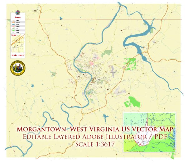
Morgantown, West Virginia, is a city with a unique topography and a mix of residential, commercial, and educational areas. The city is home to West Virginia University (WVU), which significantly influences its character and population.
Vectormap.Net provide you with the most accurate and up-to-date vector maps in Adobe Illustrator, PDF and other formats, designed for editing and printing. Please read the vector map descriptions carefully.
Below is a general overview of the districts, communities, and street system in Morgantown:
Districts:
- Downtown Morgantown:
- Located near the Monongahela River, downtown Morgantown serves as the city’s commercial and cultural hub.
- It features a mix of shops, restaurants, offices, and entertainment venues.
- High Street is a central thoroughfare in downtown Morgantown, hosting various businesses and serving as a popular hangout spot for students.
- Suncrest:
- Situated east of downtown, Suncrest is a primarily residential area with a mix of housing options.
- Suncrest Town Center is a commercial development within this district, offering shopping, dining, and entertainment.
- South Park:
- South Park is a residential area south of downtown Morgantown, featuring parks and green spaces.
- The neighborhood has a mix of housing, including single-family homes and apartments.
- Sabraton:
- Located to the southwest of downtown, Sabraton is a diverse residential area with a mix of housing types.
- It features shopping centers, schools, and parks, making it a well-rounded community.
- Evansdale:
- Home to the WVU Evansdale Campus, this area is known for its educational institutions, including engineering and agriculture facilities.
- Evansdale Crossing is a major facility in this district, offering various services and amenities.
Communities:
- Wiles Hill:
- A residential neighborhood near the WVU campus with a mix of housing, including historic homes and apartments.
- Greenmont:
- A community with a mix of residential and commercial properties, located southeast of downtown Morgantown.
- Woodburn:
- Adjacent to the downtown area, Woodburn is known for its historic architecture and is home to both permanent residents and students.
Street System:
- High Street:
- High Street is a major thoroughfare running through downtown Morgantown, lined with shops, restaurants, and businesses.
- Beechurst Avenue:
- Connecting downtown Morgantown to the WVU Evansdale Campus, Beechurst Avenue is a key route for students and residents alike.
- University Avenue:
- Running through the WVU downtown campus, University Avenue is a central road for accessing various university buildings and facilities.
- Willey Street:
- Located near the downtown area, Willey Street is known for its historic architecture and proximity to the WVU campus.
- Mileground Road:
- An important route in the Suncrest area, connecting to major shopping centers and Suncrest Town Center.
Morgantown’s layout is influenced by the hilly terrain, the Monongahela River, and the presence of West Virginia University. This creates a diverse and dynamic cityscape with a mix of residential, commercial, and academic spaces.


 Author: Kirill Shrayber, Ph.D. FRGS