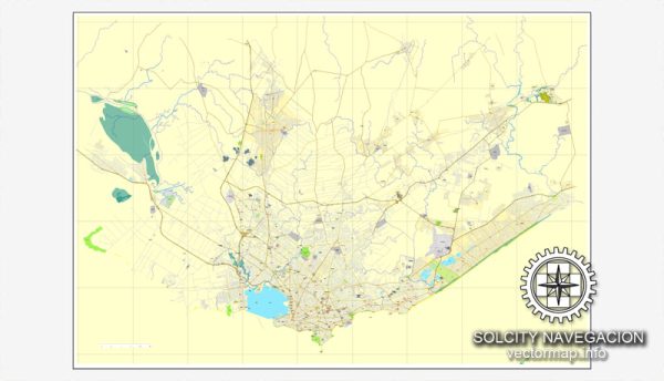
Montevideo, the capital and largest city of Uruguay, has a rich urban history that reflects the country’s cultural, economic, and political development.
Vectormap.Net provide you with the most accurate and up-to-date vector maps in Adobe Illustrator, PDF and other formats, designed for editing and printing. Please read the vector map descriptions carefully.
Here’s a detailed overview of the urban history and street system of Montevideo:
Urban History:
- Colonial Era (1724-1828):
- Montevideo’s history dates back to the Spanish colonial period when it was founded in 1724 as a military stronghold.
- The city’s strategic location near the Rio de la Plata estuary contributed to its growth as a port and trading center.
- Montevideo changed hands between Spanish and Portuguese forces several times during regional conflicts.
- Independence and Early 19th Century (1828-1900):
- Uruguay gained independence in 1828, and Montevideo became the capital of the new nation.
- The city experienced rapid growth and development during the 19th century, attracting immigrants and fostering economic activities.
- European influences, especially from Spain and Italy, contributed to the architectural and cultural diversity of the city.
- 20th Century and Modernization:
- Montevideo continued to modernize in the early 20th century, with the construction of public buildings, parks, and infrastructure projects.
- Economic challenges, political turmoil, and social movements also shaped the city’s development during this period.
- The mid-20th century saw further urban expansion and the development of suburbs as the population grew.
- Military Dictatorship (1973-1985):
- During the military dictatorship, which lasted from 1973 to 1985, Montevideo experienced social and economic challenges.
- Political repression and economic difficulties affected the city’s growth, but it rebounded after the return to democracy.
- Contemporary Era (1985-Present):
- Since the return to democracy, Montevideo has focused on urban renewal, social development, and sustainable practices.
- The city has implemented policies to enhance public spaces, improve infrastructure, and address social inequalities.
Street System:
- Ciudad Vieja:
- The historic district of Ciudad Vieja is characterized by narrow, winding streets that reflect its colonial past.
- Cobbled streets and colonial architecture make this area a popular destination for tourists and locals alike.
- Avenida 18 de Julio:
- Avenida 18 de Julio is the main avenue and one of the most important commercial and cultural hubs in Montevideo.
- It runs through the heart of the city, hosting shops, theaters, and cultural institutions.
- Barrios (Neighborhoods):
- Montevideo is divided into various neighborhoods, each with its own unique character and charm.
- Pocitos, Punta Carretas, and Carrasco are affluent neighborhoods with upscale residences and amenities.
- Rambla of Montevideo:
- The Rambla is a continuous coastal avenue that stretches along the coastline of Montevideo.
- It offers beautiful views of the Rio de la Plata and serves as a popular recreational space for residents.
- Public Transportation:
- Montevideo has a well-developed public transportation system, including buses and taxis, facilitating movement within the city.
- The city has also invested in bicycle lanes and pedestrian-friendly areas.
Montevideo’s urban history and street system reveal a blend of historical influences, modernization efforts, and a commitment to creating a vibrant and inclusive urban environment. The city continues to evolve, embracing its past while adapting to the needs of its diverse and growing population.


 Author: Kirill Shrayber, Ph.D. FRGS