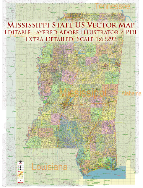
A general overview of the cities, towns, roads, and streets infrastructure in the state of Mississippi, United States.
Vectormap.Net provide you with the most accurate and up-to-date vector maps in Adobe Illustrator, PDF and other formats, designed for editing and printing. Please read the vector map descriptions carefully.
Cities and Towns:
- Jackson: The capital and largest city of Mississippi, Jackson is a cultural and economic hub. It has a diverse range of neighborhoods, including Belhaven, Fondren, and Downtown.
- Gulfport: Located on the Gulf of Mexico, Gulfport is a major port city with a focus on shipping and trade. It features beautiful beaches and a vibrant waterfront.
- Biloxi: Known for its casinos and resorts, Biloxi is a popular tourist destination on the Gulf Coast. It offers a mix of entertainment, dining, and outdoor activities.
- Hattiesburg: Home to the University of Southern Mississippi, Hattiesburg is a college town with a youthful energy. It has a mix of historic and modern neighborhoods.
- Oxford: Home to the University of Mississippi (Ole Miss), Oxford is known for its literary and cultural heritage. The town square is a focal point for events and gatherings.
- Starkville: Another college town, Starkville is home to Mississippi State University. It has a lively atmosphere, particularly during college football season.
Roads and Highways:
- Interstate Highways: Mississippi is crisscrossed by several major interstates, including I-55, I-20, and I-59. These highways facilitate both local and interstate travel.
- U.S. Highways: U.S. routes, such as US-49 and US-82, connect various cities and towns, playing a crucial role in the state’s transportation network.
- State Highways: Mississippi has an extensive network of state highways, providing connectivity to smaller towns and rural areas.
Streets Infrastructure:
- Downtown Areas: Major cities like Jackson have well-defined downtown areas with a mix of commercial, residential, and cultural spaces. Streets in these areas often feature historic architecture.
- Residential Neighborhoods: Cities and towns across Mississippi have diverse residential neighborhoods with tree-lined streets and a mix of housing styles, from historic homes to modern developments.
- Waterfront Areas: Cities along the Gulf Coast, like Biloxi and Gulfport, have waterfront districts with scenic views, recreational areas, and entertainment options.
- Historic Districts: Many cities have designated historic districts with preserved architecture, charming streets, and cultural significance.
- Rural Roads: Mississippi’s rural areas are connected by a network of roads that traverse farmland, forests, and small communities.
Infrastructure Challenges:
Mississippi, like many states, faces infrastructure challenges, including maintaining and improving roads and bridges, addressing issues related to flooding in certain areas, and ensuring reliable utilities.
For the most up-to-date and detailed information, it is recommended to refer to local government sources, transportation departments, and recent publications.


 Author: Kirill Shrayber, Ph.D. FRGS