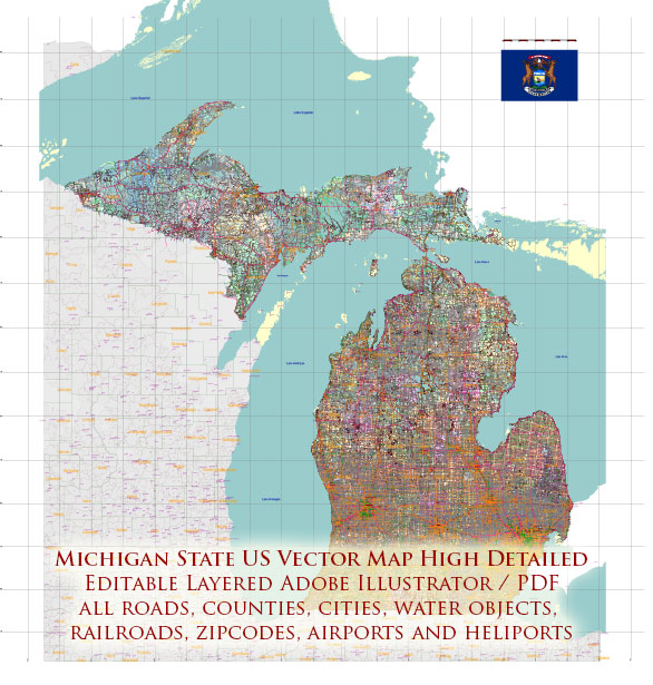
Michigan, located in the Great Lakes region of the United States, has a rich history and a well-developed transportation infrastructure.
Vectormap.Net provide you with the most accurate and up-to-date vector maps in Adobe Illustrator, PDF and other formats, designed for editing and printing. Please read the vector map descriptions carefully.
Let’s delve into the historical and transportation aspects of Michigan:
Historical Overview:
Native American Presence:
Before European exploration and settlement, Michigan was inhabited by various Native American tribes, including the Ojibwa, Potawatomi, and Odawa in the north, and the Wyandot, Miami, and Sauk in the south.
European Exploration and Colonization:
The French explorer Antoine de la Mothe Cadillac founded Detroit in 1701, marking the beginning of European presence in the region. Michigan became part of New France, later passing into British control during the French and Indian War. After the American Revolution, it became part of the Northwest Territory.
Statehood and Growth:
Michigan was established as a territory in 1805 and achieved statehood in 1837. The state’s growth was closely tied to its abundant natural resources, particularly timber and minerals. The automotive industry, led by companies like Ford, General Motors, and Chrysler, became a major economic force in the early 20th century.
Industrialization and Urbanization:
During the late 19th and early 20th centuries, industrialization transformed Michigan into a manufacturing hub. Cities like Detroit became synonymous with the automobile industry, and the state played a crucial role in the country’s economic development.
Transportation Infrastructure:
Roads and Highways:
Michigan has an extensive road network, with a well-developed system of highways and interstates. Notably, the state is known for its robust freeway system, and it’s home to the iconic “Motor City,” Detroit, a global center of the automotive industry.
Automobile Industry:
The automotive industry has significantly influenced Michigan’s transportation landscape. The “Big Three” automakers – Ford, General Motors, and Chrysler – have their headquarters in the state. Detroit, in particular, is considered the automotive capital of the world.
Railroads:
Michigan has a well-established railroad system that played a crucial role in the state’s industrialization. While railroads were essential in the past for transporting goods and people, their significance has diminished with the rise of automobiles and trucks.
Airports:
Michigan has several airports, with Detroit Metropolitan Wayne County Airport being the largest and most prominent. This airport serves as a major hub for domestic and international flights, connecting Michigan to various destinations.
Water Transportation:
Given its location on the Great Lakes, Michigan has a robust system of ports and waterways. The Soo Locks, connecting Lake Superior to the lower Great Lakes, facilitate the transportation of goods and resources.
Public Transportation:
In addition to private vehicles, Michigan has public transportation options, including buses and commuter rail services, mainly serving urban areas like Detroit.
Michigan’s history and transportation infrastructure are deeply intertwined, reflecting its economic development and industrial prowess, especially in the automotive sector. The state continues to evolve, adapting to new challenges and technological advancements in transportation.


 Author: Kirill Shrayber, Ph.D.