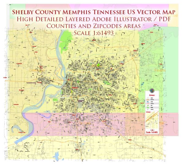
A general overview of the districts, communities, and street system in Memphis and Shelby County, Tennessee.
Vectormap.Net provide you with the most accurate and up-to-date vector maps in Adobe Illustrator, PDF and other formats, designed for editing and printing. Please read the vector map descriptions carefully.
Districts: Memphis is a city located in the southwestern part of the U.S. state of Tennessee, and Shelby County is the most populous county in the state. Memphis itself is divided into several districts, each with its own unique characteristics and features. Some of the notable districts in Memphis include:
- Downtown Memphis: The central business district, home to iconic landmarks such as Beale Street, the FedExForum, and the Mississippi Riverfront.
- Midtown Memphis: Known for its eclectic neighborhoods, historic architecture, and cultural attractions. Overton Park, the Memphis Zoo, and the Cooper-Young Historic District are located in Midtown.
- East Memphis: A predominantly residential and commercial area, known for its shopping centers, business parks, and upscale neighborhoods.
- South Memphis: Historically significant, with areas like Soulsville, home to the Stax Museum of American Soul Music. This district has a rich cultural heritage.
- Whitehaven: Located in the southern part of Memphis, known for being the home of Graceland, Elvis Presley’s former residence.
- Cordova: Located in the eastern part of the county, it’s a mix of residential and commercial areas.
Communities: Shelby County, beyond Memphis, includes numerous communities and neighborhoods. Some notable ones include Germantown, Collierville, Bartlett, and Millington.
- Germantown: A suburb known for its excellent schools, parks, and upscale residential areas.
- Collierville: Another suburban community with a historic town square, parks, and a family-friendly atmosphere.
- Bartlett: A city to the northeast of Memphis, known for its parks, recreational facilities, and a mix of residential and commercial areas.
- Millington: Located in the northern part of the county, it’s known for being the site of the Naval Support Activity Mid-South and the Memphis International Raceway.
Street System: Memphis has a grid-based street system, and the city is known for its wide streets. The downtown area is characterized by numbered streets and avenues. Beale Street is one of the most famous streets, known for its historic significance and vibrant nightlife.
Major thoroughfares include Interstate 40, Interstate 240, and Interstate 55, connecting Memphis with other parts of the region. Memphis International Airport is located to the southeast of downtown, providing air travel access.
For the most accurate and up-to-date information on the districts, communities, and street system, it’s recommended to consult local government sources, maps, or community websites as these details may have evolved since my last update.


 Author: Kirill Shrayber, Ph.D. FRGS