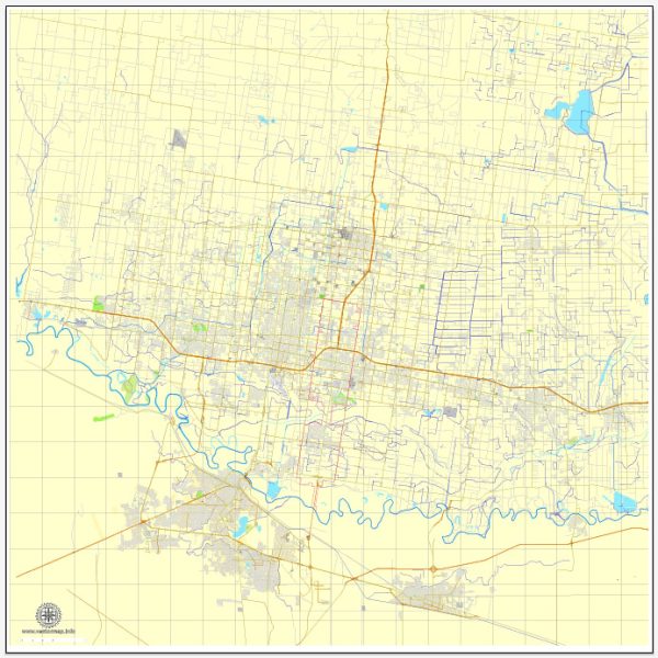
McAllen, Texas, a general overview of the city’s layout and some information about its neighborhoods.
Vectormap.Net provide you with the most accurate and up-to-date vector maps in Adobe Illustrator, PDF and other formats, designed for editing and printing. Please read the vector map descriptions carefully.
McAllen is a city located in Hidalgo County in the southern part of Texas, near the U.S.-Mexico border. It is part of the larger Rio Grande Valley region. The city is known for its cultural diversity, vibrant community, and economic activities.
- Districts:
- McAllen doesn’t have distinct districts in the way that larger cities might. However, it has various areas with commercial, residential, and industrial development.
- Communities:
- McAllen is home to various neighborhoods and communities, each with its own character and amenities. Some of the notable neighborhoods include:
- North McAllen: This area includes residential neighborhoods, schools, and parks.
- South McAllen: The southern part of the city has a mix of residential and commercial areas.
- East McAllen: This area is known for its shopping centers, restaurants, and entertainment options.
- West McAllen: A mix of residential and commercial developments.
- McAllen is home to various neighborhoods and communities, each with its own character and amenities. Some of the notable neighborhoods include:
- Street System:
- The street system in McAllen, like many American cities, is typically organized on a grid pattern. Major streets run north-south or east-west.
- Some significant streets in McAllen include 10th Street, 23rd Street, and Nolana Avenue. These streets often host commercial and retail establishments.
- McAllen is well-connected with a network of roads and highways, including Interstate 2 and Interstate 69C, making it accessible to neighboring cities.
- Landmarks and Points of Interest:
- La Plaza Mall: One of the largest shopping malls in the region, offering a wide range of retail options.
- McAllen Convention Center: A venue for events, conferences, and exhibitions.
- Quinta Mazatlán: A historical mansion and nature and birding center.
- McAllen International Airport: Providing air travel connections for the region.
For the most current and detailed information about specific districts, communities, and streets in McAllen, I recommend checking with the local city government, community organizations, or online maps and directories for the latest updates.


 Author: Kirill Shrayber, Ph.D. FRGS