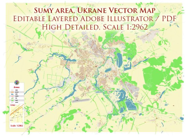
Some general information about Sumy, Ukraine, including its urban history and street system.
Vectormap.Net provide you with the most accurate and up-to-date vector maps in Adobe Illustrator, PDF and other formats, designed for editing and printing. Please read the vector map descriptions carefully.
Urban History:
Early History:
Sumy is one of the oldest cities in Ukraine, with a history dating back to the 17th century. It was founded in 1652 as a fortress to protect the southern borders of the Russian Tsardom from the Crimean Tatars and the Ottoman Empire.
Development:
Throughout the centuries, Sumy grew as a trade and administrative center. It played a significant role in the economic and cultural life of the region. In the 19th century, Sumy became an important junction for railways, further boosting its economic importance.
Soviet Era:
During the Soviet era, Sumy, like many other cities, experienced industrialization and urbanization. The city became an industrial center with a focus on engineering, machinery, and electronics.
Post-Soviet Era:
With the dissolution of the Soviet Union in 1991, Sumy became part of the independent Ukraine. The city faced economic challenges during the transition period, but efforts were made to adapt to the new political and economic realities.
Street System:
Layout:
Sumy has a typical grid-like street layout, with straight and intersecting streets forming rectangular blocks. The central part of the city often features wider avenues and squares, while the outskirts may have a more varied pattern.
Key Streets and Landmarks:
- Petrovskaya Street: This is one of the main streets in Sumy, often considered its central axis. It’s likely to be a hub of commercial and cultural activity.
- Kurskaya Street: Another important thoroughfare in Sumy, Kurskaya Street might host various shops, restaurants, and offices.
- Independence Square: Many cities in Ukraine have a central square named Independence Square, and Sumy may have its version. Such squares often serve as focal points for public events and gatherings.
- Lenin Avenue: Named after Vladimir Lenin, this avenue was common in Soviet-era city planning. However, it might have been renamed or redesigned since then due to political changes.
Infrastructure:
Sumy’s infrastructure includes a network of roads, bridges, and public transportation. The city likely has bus routes and may also have a tram system. Infrastructure development is crucial for the city’s functionality and residents’ mobility.
For the most accurate and up-to-date information, especially regarding changes in street names or urban planning, it’s recommended to refer to local government sources, city planning departments, or recent maps of Sumy.


 Author: Kirill Shrayber, Ph.D.