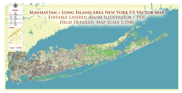
Manhattan and Long Island, located in the state of New York, are primarily urban and suburban areas with a limited amount of large natural parks. However, there are several green spaces, nature reserves, and recreational areas that offer a retreat from the bustling city life.
Vectormap.Net provide you with the most accurate and up-to-date vector maps in Adobe Illustrator, PDF and other formats, designed for editing and printing. Please read the vector map descriptions carefully.
Let’s explore some of the notable natural attractions in these regions:
Manhattan:
- Central Park:
- Location: Central Park spans 843 acres in the heart of Manhattan.
- Description: Central Park is an iconic urban oasis, featuring a diverse range of landscapes, including meadows, woodlands, lakes, and recreational facilities. Visitors can enjoy walking and biking paths, rowing on the lake, picnicking, and various outdoor events. The Central Park Conservancy works to maintain the park’s natural beauty and historical features.
- The High Line:
- Location: This linear park is built on a former elevated railway track on the west side of Manhattan.
- Description: The High Line offers a unique elevated perspective of the city and features landscaped gardens, art installations, and public spaces. It’s a popular spot for walking, relaxation, and enjoying urban greenery.
- Inwood Hill Park:
- Location: Located at the northern tip of Manhattan.
- Description: Inwood Hill Park is a natural gem with forests, salt marshes, and the only natural forest left on Manhattan Island. It provides hiking trails, views of the Hudson River, and historical sites like the Shorakkopoch Rock, where Peter Minuit is believed to have “purchased” Manhattan from the Lenape Native Americans.
Long Island:
- Montauk Point State Park:
- Location: At the eastern tip of Long Island.
- Description: Montauk Point State Park offers stunning coastal views, hiking trails, and the historic Montauk Lighthouse. Visitors can enjoy picnicking, fishing, birdwatching, and exploring the maritime environment.
- Fire Island National Seashore:
- Location: A barrier island off the southern coast of Long Island.
- Description: This national seashore features pristine beaches, salt marshes, and maritime forests. It’s a protected area with diverse ecosystems, and visitors can explore the natural beauty, spot wildlife, and participate in various outdoor activities.
Tourism:
- Coney Island:
- Location: Southwestern part of Brooklyn, near the southern tip of Long Island.
- Description: Coney Island is known for its historic amusement parks, iconic boardwalk, and beautiful beaches. It’s a popular destination for families and tourists, offering entertainment, carnival rides, and the famous annual Mermaid Parade.
- Wineries on the North Fork:
- Location: The North Fork of Long Island.
- Description: Long Island’s North Fork is known for its vineyards and wineries. Wine enthusiasts can take tours, enjoy tastings, and explore the picturesque countryside. It’s a relaxing way to experience the natural beauty of Long Island.
While Manhattan is more known for its urban attractions, both Manhattan and Long Island offer a mix of natural spaces and recreational areas for locals and visitors to enjoy.


 Author: Kirill Shrayber, Ph.D.