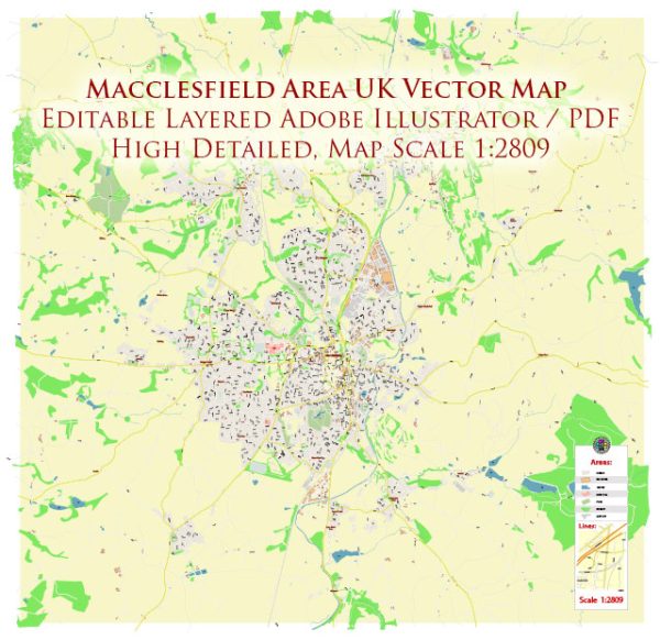
Macclesfield, located in the county of Cheshire, England, is a town with a rich history dating back centuries. It has a variety of historic places, buildings, streets, and squares that reflect its cultural and architectural heritage. A general overview.
Vectormap.Net provide you with the most accurate and up-to-date vector maps in Adobe Illustrator, PDF and other formats, designed for editing and printing. Please read the vector map descriptions carefully.
Here are some notable historic features in Macclesfield:
- St. Michael’s Church:
- St. Michael’s Church is an iconic landmark in Macclesfield, with its origins dating back to the 13th century.
- The church has a distinctive medieval tower and features a mix of architectural styles, including Gothic and Perpendicular.
- Macclesfield Town Hall:
- The Town Hall is a Victorian-era building that stands in the heart of Macclesfield. It was constructed in the mid-19th century and showcases impressive architecture.
- The interiors of the Town Hall often host various events and ceremonies.
- Silk Museum:
- Macclesfield has a historical connection with the silk industry, and the Silk Museum reflects this heritage. The museum provides insights into the town’s silk production history and its impact on the local economy.
- Paradise Mill:
- This restored 19th-century silk mill is now a museum. Paradise Mill offers guided tours, allowing visitors to explore the working conditions of silk workers during the industrial revolution.
- West Park:
- West Park is a beautiful public park with well-maintained gardens and a lake. It’s a great place for a leisurely stroll and provides a peaceful retreat in the heart of the town.
- Castle Street Conservation Area:
- This area is known for its well-preserved Georgian and Victorian architecture. The buildings along Castle Street showcase the town’s historical development and architectural evolution.
- Market Place:
- Macclesfield’s Market Place is a bustling area with a mix of historic and modern buildings. The market itself has a long history and continues to be an essential part of the town’s social and economic life.
- King Edward Street:
- This street is home to several historic buildings and shops. The architecture along King Edward Street reflects different periods of Macclesfield’s history.
- Chester Road Conservation Area:
- Another area with a conservation designation, Chester Road, features a collection of Victorian and Edwardian buildings, contributing to the town’s architectural character.
- Hibel Road Conservation Area:
- Hibel Road is known for its well-preserved Victorian and Edwardian buildings, contributing to the architectural charm of Macclesfield.
Exploring Macclesfield’s historic sites, streets, and squares offers a glimpse into the town’s past and the various influences that have shaped its development over the centuries. Keep in mind that ongoing preservation efforts and community initiatives may lead to additional discoveries and enhancements to the town’s historic character.


 Author: Kirill Shrayber, Ph.D. FRGS