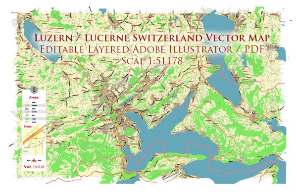
A general overview of the political and transportation history of Lucerne, Switzerland.
Vectormap.Net provide you with the most accurate and up-to-date vector maps in Adobe Illustrator, PDF and other formats, designed for editing and printing. Please read the vector map descriptions carefully.
Political History:
Early History:
Lucerne, situated in the heart of Switzerland, has a rich history dating back to the Middle Ages. The region was initially settled by the Celts and later became part of the Roman Empire. In the medieval period, Lucerne emerged as a market town and played a crucial role in the economic and political life of the region.
Formation of the Swiss Confederacy:
Lucerne joined the Swiss Confederacy in 1332, marking the city’s commitment to the struggle for independence from the Habsburgs. The Battle of Morgarten in 1315 and the Battle of Sempach in 1386 were significant events during this period, strengthening the Swiss Confederacy.
Reformation and Counter-Reformation:
The 16th century saw the Reformation sweeping through Europe, leading to religious and political changes. Lucerne, however, remained a stronghold of the Catholic Church, actively resisting the Reformation. The Counter-Reformation was also influential in shaping the religious landscape.
Napoleonic Era and Modern Switzerland:
During the Napoleonic era, Lucerne experienced various changes in political structures. After the Congress of Vienna in 1815, Switzerland underwent a reorganization, leading to the establishment of the modern federal state. Lucerne continued to be an integral part of this federal structure.
19th and 20th Centuries:
In the 19th century, Lucerne underwent industrialization and urbanization. The city developed as a cultural and economic center. Switzerland’s policy of neutrality during both World Wars allowed Lucerne to remain relatively untouched by the conflicts that affected many other European cities.
Transportation History:
Early Transportation:
In its early history, Lucerne’s transportation relied heavily on waterways. Lake Lucerne and the River Reuss provided essential means for trade and communication. The city’s strategic location facilitated trade routes between northern and southern Europe.
Development of Railways:
The introduction of railways in the 19th century had a profound impact on Lucerne’s transportation. The Swiss Federal Railways (SBB) connected Lucerne to the national rail network, significantly improving accessibility and fostering economic growth.
Road and Infrastructure:
The 20th century witnessed advancements in road infrastructure, enhancing connectivity within Lucerne and its surrounding regions. Improved roads and bridges played a crucial role in the city’s development and accessibility.
Modern Transportation:
Lucerne boasts a well-developed and efficient transportation system in the 21st century. It is served by an extensive network of roads, railways, and public transportation. The city’s transportation infrastructure facilitates tourism, business, and daily commuting.


 Author: Kirill Shrayber, Ph.D.