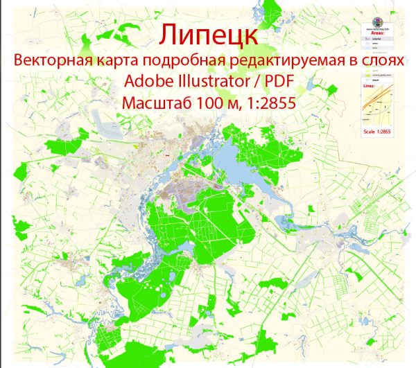
Some detailed information about the industrial history and road system of Lipetsk, Russia, a general overview of the city and some aspects that are likely to contribute to its industrial development.
Vectormap.Net provide you with the most accurate and up-to-date vector maps in Adobe Illustrator, PDF and other formats, designed for editing and printing. Please read the vector map descriptions carefully.
Industrial History:
- Metallurgical Industry:
- Lipetsk is known for its strong presence in the metallurgical industry. The Lipetsk Metallurgical Plant (LMZ) is one of the largest and oldest metallurgical enterprises in Russia.
- The plant has been a key player in producing various metal products, including steel and steel products, contributing significantly to the industrial landscape of the region.
- Chemical Industry:
- The city is also home to chemical industries that play a role in the local economy. The chemical sector often develops alongside metallurgy to provide necessary materials for industrial processes.
- Agricultural Machinery:
- Lipetsk has been involved in the production of agricultural machinery, including tractors and equipment. This ties into the broader agricultural activities in the region.
Road System:
- Infrastructure Development:
- Like many other Russian cities, Lipetsk has likely seen continuous infrastructure development, including the expansion and improvement of its road network.
- The road system is crucial for the transportation of goods and people, facilitating economic activities and regional connectivity.
- Federal Highways:
- Russia has an extensive network of federal highways, and Lipetsk is likely connected to this network, allowing for efficient transportation to and from the city.
- The M4 Don highway, which connects Moscow to the southern regions of Russia, passes through Lipetsk and contributes to the city’s transportation infrastructure.
- Local Roads:
- Local roads within Lipetsk would connect various industrial zones, residential areas, and commercial districts.
- The development and maintenance of local roads are essential for the city’s overall functionality and economic activities.
- Transportation Hubs:
- Lipetsk may have transportation hubs like bus stations and railway connections, providing various options for both local and long-distance travel.


 Author: Kirill Shrayber, Ph.D. FRGS