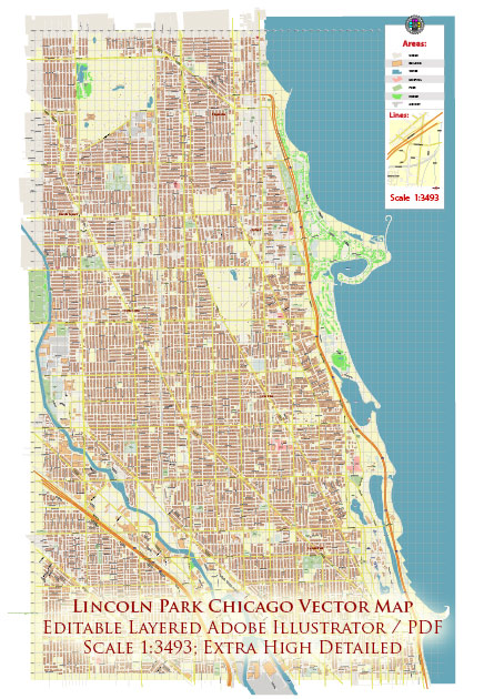
Lincoln Park is one of the well-known neighborhoods in Chicago, Illinois, and it has a rich urban history that has evolved over the years.
Vectormap.Net provide you with the most accurate and up-to-date vector maps in Adobe Illustrator, PDF and other formats, designed for editing and printing. Please read the vector map descriptions carefully.
Here’s a detailed overview of the urban history and street system of Lincoln Park:
Urban History:
- Early Settlement: Lincoln Park was initially settled in the mid-19th century and was named after President Abraham Lincoln. During this period, it was largely rural and known for its natural beauty.
- Development and Growth: As Chicago experienced rapid urbanization in the late 19th century, Lincoln Park transformed into a more developed residential area. Victorian-style homes and mansions were built, attracting affluent residents.
- Great Chicago Fire (1871): The Great Chicago Fire had a significant impact on the city’s development, including Lincoln Park. The fire destroyed a large portion of the city, leading to the reconstruction of buildings and infrastructure.
- Cultural and Educational Hub: Over time, Lincoln Park became a cultural and educational hub with the establishment of institutions such as DePaul University and the Chicago History Museum. The neighborhood also features a diverse range of cultural venues, including theaters, galleries, and music venues.
- Park Development: The actual Lincoln Park, after which the neighborhood is named, underwent significant development. Originally conceived as a cemetery, it was later transformed into a large public park with recreational facilities, gardens, and the Lincoln Park Zoo.
- Modern Era: In the 20th century, Lincoln Park experienced demographic shifts and became a desirable area for young professionals, artists, and students. The neighborhood has maintained a balance between historical preservation and modern development.
Street System:
- Grid Layout: Like much of Chicago, Lincoln Park follows a grid street layout, making navigation relatively straightforward. The grid is characterized by numbered streets running north-south and named avenues running east-west.
- Major Streets and Avenues:
- Armitage Avenue: A popular shopping street with a mix of boutiques, restaurants, and cafes.
- Clark Street: A vibrant commercial corridor with a variety of shops, restaurants, and entertainment options.
- Fullerton Avenue: A major east-west street connecting Lincoln Park to other neighborhoods, known for its green spaces and recreational areas.
- Halsted Street: A lively street with a diverse range of businesses, including bars, theaters, and restaurants.
- Residential Blocks: Lincoln Park’s residential areas are characterized by tree-lined streets, historic brownstone buildings, and a mix of architectural styles. Many streets feature a combination of single-family homes, multi-unit buildings, and apartment complexes.
- Public Transportation: The neighborhood is well-connected with public transportation, including buses and the Chicago Transit Authority (CTA) train system. The Fullerton and Armitage stations are important transit hubs in the area.
In summary, Lincoln Park has a fascinating urban history that reflects Chicago’s overall development. Its street system is designed for accessibility and includes a mix of commercial, residential, and recreational spaces, making it a dynamic and attractive neighborhood in the city.


 Author: Kirill Shrayber, Ph.D. FRGS