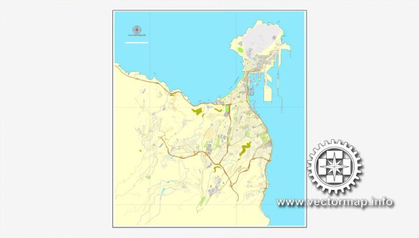
Las Palmas is a city and port on the island of Gran Canaria, which is part of the Canary Islands, an autonomous community of Spain. The port of Las Palmas is a significant maritime hub in the Atlantic Ocean, serving both as a commercial and passenger port.
Vectormap.Net provide you with the most accurate and up-to-date vector maps in Adobe Illustrator, PDF and other formats, designed for editing and printing. Please read the vector map descriptions carefully.
Port of Las Palmas:
- Location:
- The Port of Las Palmas is strategically located on the northeastern coast of Gran Canaria.
- It is one of the main ports in the Atlantic and serves as a vital transshipment point for goods between Europe, Africa, and the Americas.
- Facilities:
- The port has various terminals and facilities for handling different types of cargo, including containers, bulk cargo, and general cargo.
- Passenger terminals cater to cruise ships, ferry services, and other maritime tourism activities.
- Container Terminals:
- The port has container terminals equipped with modern container-handling facilities.
- These terminals facilitate the transshipment of containers and contribute to the region’s import and export activities.
- Bulk Cargo Handling:
- The port handles bulk cargo, including commodities such as grain, oil, and minerals.
- Specialized terminals are designed to efficiently manage the specific requirements of bulk cargo shipments.
- Cruise and Passenger Terminals:
- Las Palmas is a popular destination for cruise ships, and the port has dedicated terminals to handle passenger traffic.
- These terminals are equipped with amenities and services for tourists arriving on cruise ships.
- Logistics and Connectivity:
- The port is well-connected to transportation networks, facilitating the smooth movement of goods to and from the port.
- Road and rail links provide efficient connectivity to the rest of the island and beyond.
- Free Trade Zone:
- Las Palmas has a Free Trade Zone (Zona Franca) within the port area, providing a business-friendly environment for international trade and commerce.
- Infrastructure Investment:
- Over the years, the Port of Las Palmas has seen infrastructure improvements and investments to enhance its capacity and efficiency.
- Security and Environmental Measures:
- Modern ports prioritize security measures to ensure the safe handling of goods and the protection of maritime assets.
- Environmental sustainability initiatives may include measures to reduce emissions and adopt eco-friendly practices.
- Regulatory Framework:
- The port operates within the regulatory framework set by Spanish and European Union authorities, ensuring compliance with international maritime standards.
For the most up-to-date and specific information on Las Palmas’ transportation and port infrastructure, it is advisable to check with local port authorities, government agencies, or official publications.


 Author: Kirill Shrayber, Ph.D. FRGS