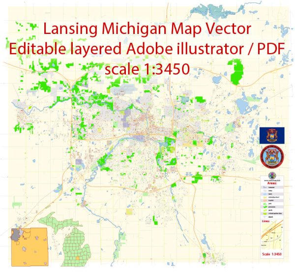
Lansing, the capital city of the state of Michigan, has a rich industrial history and a well-developed road system.
Vectormap.Net provide you with the most accurate and up-to-date vector maps in Adobe Illustrator, PDF and other formats, designed for editing and printing. Please read the vector map descriptions carefully.
Here’s a detailed overview:
Industrial History:
Early Years:
- 1847-1855: Lansing was chosen as the state capital in 1847, and its early years were marked by slow growth and agricultural activities.
- Late 19th Century: The city’s industrialization began in the late 19th century, driven by the growth of the automotive and manufacturing industries.
Automotive Industry:
- Early 20th Century: Lansing became a significant player in the automotive industry. The Oldsmobile brand was founded here in 1897 by Ransom E. Olds, and by 1901, it was producing the first mass-produced automobiles.
- General Motors (GM): The presence of General Motors (GM) became prominent in Lansing. GM established multiple manufacturing facilities, including the Grand River Assembly Plant and the Lansing Car Assembly Plant.
Manufacturing and Economy:
- Mid-20th Century: Lansing’s economy diversified with the growth of manufacturing sectors beyond automotive, including steel production, food processing, and the production of industrial machinery.
- Recent Decades: The economy has continued to diversify, with a focus on healthcare, education, and technology sectors.
Road System:
Early Roads:
- 19th Century: Like many cities, Lansing’s early road system consisted of dirt roads and trails connecting it to nearby communities and facilitating trade.
- Railroads: The advent of railroads in the mid-19th century played a crucial role in connecting Lansing to other parts of the state and nation.
Paved Roads and Highways:
- Early 20th Century: The rise of automobiles prompted the need for better road infrastructure. Paved roads and highways started to replace dirt roads.
- US Route 127: Lansing is intersected by major highways, including US Route 127, which connects the city to other parts of Michigan and beyond.
- I-96 and I-496: Interstate 96 and Interstate 496 are key highways serving Lansing, facilitating transportation and connecting the city to major centers like Detroit and Grand Rapids.
Public Transportation:
- Bus Services: The Capital Area Transportation Authority (CATA) provides bus services in the Lansing area, contributing to public transportation accessibility.
- Biking and Walking Paths: Efforts have been made to create biking and walking paths, promoting alternative transportation methods and enhancing connectivity within the city.
Recent Developments:
- Infrastructure Improvements: Ongoing infrastructure projects aim to enhance road networks, reduce traffic congestion, and improve overall transportation efficiency.
- Smart City Initiatives: Lansing has explored smart city initiatives to incorporate technology into its transportation infrastructure for improved efficiency and sustainability.
In summary, Lansing’s industrial history is closely tied to the automotive industry, with General Motors playing a significant role. Over the years, the city’s economy has diversified, and its road system has evolved to meet the demands of a growing and changing community.


 Author: Kirill Shrayber, Ph.D. FRGS