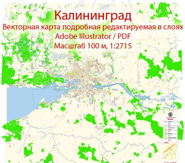
Kaliningrad, formerly known as Königsberg, is a city in the Russian Federation located on the Baltic Sea. Its history is rich and complex, shaped by different periods of rule, cultural influences, and geopolitical changes.
Vectormap.Net provide you with the most accurate and up-to-date vector maps in Adobe Illustrator, PDF and other formats, designed for editing and printing. Please read the vector map descriptions carefully.
Here’s a detailed overview of the urban history and street system of Kaliningrad:
Historical Overview:
- Prussian Era (1255-1945): Königsberg was founded by the Teutonic Knights in 1255. It became the capital of the Duchy of Prussia, later a part of the Kingdom of Prussia. The city flourished culturally and economically during this period.
- German Influence: Königsberg developed a distinctive Germanic character with Gothic and Renaissance architecture. Notable landmarks included the Königsberg Castle, the Cathedral, and the seven bridges over the Pregel River.
- World War II: During World War II, Königsberg suffered severe damage from Allied bombing. The city fell to the Soviet Union in 1945, and the Potsdam Agreement awarded it to the Soviet Union.
- Soviet Era (1945-present): Renamed Kaliningrad in 1946, the city underwent significant changes. Many German inhabitants were expelled or fled, and the city was repopulated with Soviet citizens. The architecture was influenced by Soviet urban planning principles.
Urban Planning and Street System:
- Soviet Urban Planning: Kaliningrad was reconstructed according to Soviet urban planning principles, with wide avenues, large squares, and monumental structures. The city center underwent a transformation, and Soviet-style apartment blocks replaced some of the historic architecture.
- Central Square: Ploshchad Pobedy (Victory Square) is the central square of Kaliningrad. It features Soviet-style architecture and is a central hub for events and gatherings.
- Street Layout: The city’s street system is a mix of Soviet planning and remnants of the pre-war German layout. Wide boulevards and spacious squares coexist with narrower streets. Some historic streets were renamed after notable Soviet figures.
- Cultural Institutions: The city is home to various cultural institutions, including museums, theaters, and educational facilities. The Kaliningrad Regional Museum of History and Art, for example, showcases the city’s past and present.
- Transportation: Kaliningrad has a well-developed transportation network. Public transportation includes buses and trams, connecting different parts of the city. The road network is essential for both local traffic and transportation between Kaliningrad and neighboring countries.
- Economic Development: Kaliningrad has seen economic development, with industries such as amber processing, fishing, and manufacturing playing crucial roles. The city’s strategic location as a Baltic Sea port contributes to its economic significance.
- Post-Soviet Changes: After the dissolution of the Soviet Union, Kaliningrad faced challenges and opportunities. The city experienced some economic difficulties, but it also attracted investments and became a special economic zone, fostering development.
In summary, Kaliningrad’s urban history reflects a blend of Prussian, German, and Soviet influences. The street system reflects both the city’s historical roots and the impact of Soviet urban planning, creating a unique blend of architectural styles and cultural heritage.


 Author: Kirill Shrayber, Ph.D.