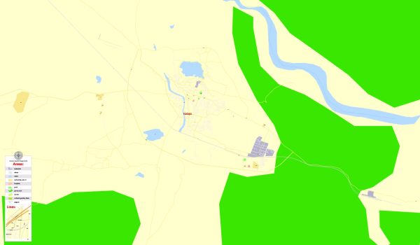
A general overview of the urban history and street system in Kadapa (formerly known as Cuddapah) in Andhra Pradesh, India.
Vectormap.Net provide you with the most accurate and up-to-date vector maps in Adobe Illustrator, PDF and other formats, designed for editing and printing. Please read the vector map descriptions carefully.
Urban History:
Early History:
Kadapa has a rich historical background, dating back to ancient times. It has been part of various dynasties, including the Mauryas, Cholas, Pallavas, and later the Vijayanagara Empire. The region has seen influences from different cultures and has been an important center for trade and commerce.
Colonial Period:
During the colonial era, Kadapa came under the rule of the British East India Company. The city witnessed changes in governance, infrastructure, and administrative structures under British rule.
Post-Independence:
After India gained independence in 1947, Kadapa became part of the state of Andhra Pradesh when it was formed in 1953. Over the years, the city has seen urbanization, economic growth, and improvements in infrastructure.
Street System:
Layout:
The street system in Kadapa is likely a mix of planned layouts and organic growth. The city may have a central business district, residential areas, and commercial zones. Streets are organized to accommodate the needs of a growing population and various economic activities.
Main Roads:
Kadapa is connected by a network of roads and highways that link it to other major cities and towns in Andhra Pradesh and neighboring states. Major roads within the city provide connectivity between different neighborhoods and landmarks.
Landmarks:
Landmarks in Kadapa may include historical sites, religious places, educational institutions, government offices, and commercial centers. These landmarks often influence the development and organization of the street system around them.
Infrastructure Development:
The city has likely witnessed ongoing infrastructure development, including the construction of new roads, bridges, and public facilities to meet the demands of a growing population. Urban planning initiatives may focus on improving traffic flow, accessibility, and overall city aesthetics.
Recent Developments (as of January 2022):
Kadapa, like many other cities in India, would be undergoing various developmental projects aimed at enhancing the quality of life for its residents. This could include initiatives related to smart city development, sanitation, transportation, and technology integration.
For the most current and detailed information about the urban history and street system in Kadapa, it is recommended to refer to recent local government records, urban planning documents, or visit official city websites. Local news sources and publications can also provide insights into the latest developments and changes in the city.


 Author: Kirill Shrayber, Ph.D.