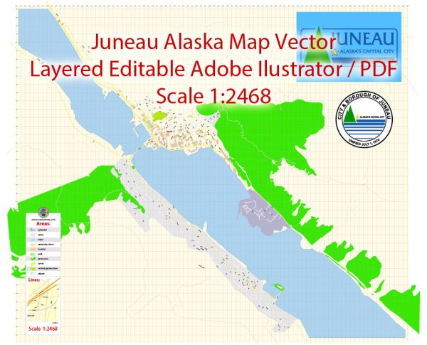
Juneau, Alaska, is the capital city of the state and is located in the southeastern part of Alaska. Its urban history and street system reflect the city’s unique geographical and historical context.
Vectormap.Net provide you with the most accurate and up-to-date vector maps in Adobe Illustrator, PDF and other formats, designed for editing and printing. Please read the vector map descriptions carefully.
Urban History:
- Tlingit Native Presence:
- Before European exploration and settlement, the area around Juneau was inhabited by the Tlingit people. They had a rich cultural history and established trade routes in the region.
- Gold Rush Era (Late 19th Century):
- Juneau’s history is closely tied to the discovery of gold in the late 19th century. In 1880, gold prospectors Joe Juneau and Richard Harris found gold in the nearby Silver Bow Basin, leading to a gold rush.
- The city of Juneau was founded in 1881, and it quickly became a hub for gold mining activities.
- Territorial Capital and Statehood:
- Juneau became the capital of the Alaska Territory in 1906, a status it retained when Alaska became a state in 1959.
- The city’s development was influenced by its role as the political center of Alaska.
- Logging and Fishing Industries:
- In addition to mining, logging and fishing industries played a significant role in Juneau’s economy.
- The city’s economy diversified over the years, and government services became a crucial component due to its status as the capital.
- Tourism Boom:
- Juneau has seen a significant increase in tourism, particularly from cruise ships, which has become a vital part of its economy.
- The city attracts visitors with its stunning natural scenery, including nearby glaciers, and opportunities for outdoor activities.
Street System:
- Downtown Juneau:
- The heart of Juneau is its downtown area, situated between the mountains and the Gastineau Channel. Historic buildings from the gold rush era still stand, contributing to the city’s charm.
- Streets in downtown Juneau are characterized by a grid pattern, but the challenging topography means that some streets have steep inclines.
- Waterfront:
- The waterfront area along the Gastineau Channel has been developed to accommodate the needs of the fishing and tourism industries.
- Streets in this area provide access to docks, where fishing boats and cruise ships dock.
- Government District:
- The government district houses the Alaska State Capitol and other government buildings. Streets in this area reflect the administrative and bureaucratic functions of the city.
- Residential Areas:
- Beyond the central business district, Juneau has various residential neighborhoods. Due to the challenging terrain, some areas may have winding streets and steep hills.
- Transportation Infrastructure:
- The city is not connected to the road system of the rest of Alaska or North America. Access to Juneau is primarily by air or sea.
- The Juneau International Airport and the Alaska Marine Highway System are critical components of the city’s transportation infrastructure.
In summary, Juneau’s urban history is rooted in the gold rush era, and its street system reflects the challenges posed by the mountainous terrain. Over the years, the city has evolved into a vibrant capital with a diverse economy and a strong focus on tourism and government services.


 Author: Kirill Shrayber, Ph.D.