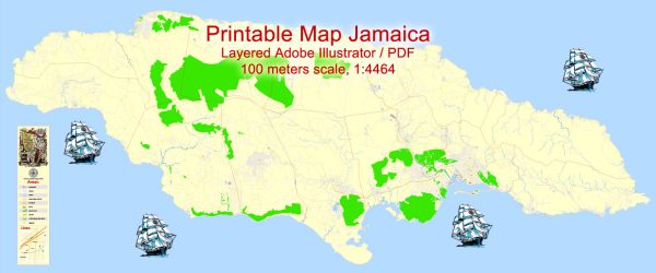
Jamaica, located in the Caribbean Sea, is the third-largest island in the Greater Antilles. It is known for its vibrant culture, stunning landscapes, and warm hospitality.
Vectormap.Net provide you with the most accurate and up-to-date vector maps in Adobe Illustrator, PDF and other formats, designed for editing and printing. Please read the vector map descriptions carefully.
The main cities and principal roads in Jamaica include:
Main Cities:
- Kingston:
- As the capital and largest city, Kingston is a major economic and cultural hub. It is located on the southeastern coast of the island. Kingston is divided into two main areas: the historic downtown and the more modern uptown. Notable landmarks include the Bob Marley Museum, Devon House, and the National Gallery of Jamaica.
- Montego Bay:
- Situated on the northwest coast, Montego Bay is a popular tourist destination known for its beautiful beaches, resorts, and vibrant nightlife. Sangster International Airport, the largest airport in Jamaica, is located here. The city is a gateway to the tourist regions of Negril and Ocho Rios.
- Ocho Rios:
- Located on the north-central coast, Ocho Rios is famous for its waterfalls, lush gardens, and tourist attractions like Dunn’s River Falls, Mystic Mountain, and Dolphin Cove. It’s a major cruise ship port and offers a mix of natural beauty and recreational activities.
- Negril:
- Positioned on the western tip of the island, Negril is renowned for its stunning seven-mile beach and vibrant nightlife. It’s a laid-back destination with numerous all-inclusive resorts, and it’s known for its beautiful sunsets at Rick’s Cafe.
- Portmore:
- A suburb of Kingston, Portmore is located to the south and is known for its residential communities and industrial areas. It has experienced significant growth and development over the years.
Principal Roads:
- A1 – North Coast Highway:
- This major highway runs along the north coast, connecting cities like Montego Bay, Ocho Rios, and Port Antonio. It offers stunning views of the Caribbean Sea and easy access to various tourist destinations.
- A3 – Mandela Highway:
- Connecting Kingston and Spanish Town, the Mandela Highway is a critical transportation link, facilitating the movement of goods and people between these two major urban centers.
- A4 – Palisadoes Road:
- Leading from Kingston to Norman Manley International Airport, Palisadoes Road offers a scenic drive along the Palisadoes Peninsula.
- A2 – Spanish Town Road:
- Connecting Kingston to Spanish Town, this road is a vital transportation route, linking the capital to one of Jamaica’s historic cities.
- A6 – Constant Spring Road:
- Located in Kingston, this road connects the city center with residential and commercial areas, including the popular Half-Way-Tree district.
Jamaica’s road network also includes numerous local roads, providing access to rural communities and agricultural areas. Travelers should exercise caution and be aware of local driving conditions when navigating Jamaican roads.


 Author: Kirill Shrayber, Ph.D. FRGS