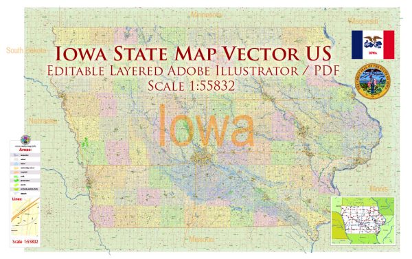
A general overview of some main cities and roads in Iowa.
Vectormap.Net provide you with the most accurate and up-to-date vector maps in Adobe Illustrator, PDF and other formats, designed for editing and printing. Please read the vector map descriptions carefully.
Main Cities in Iowa:
- Des Moines: The capital and largest city of Iowa, located in the central part of the state. It is a major hub for government, business, and culture.
- Cedar Rapids: The second-largest city and an economic hub known for its manufacturing and processing industries.
- Davenport: Located along the Mississippi River, Davenport is part of the Quad Cities metropolitan area and is known for its cultural events and historical sites.
- Sioux City: Situated in the western part of the state, Sioux City is a regional hub for commerce, industry, and tourism.
- Iowa City: Home to the University of Iowa, Iowa City has a vibrant cultural scene and is often recognized for its literary heritage.
- Ames: Known for being home to Iowa State University, Ames is a college town with a focus on education and research.
Major Roads:
- Interstate Highways:
- I-80: A major east-west interstate that crosses Iowa, connecting cities like Des Moines, Iowa City, and Davenport.
- I-35: Runs north-south, intersecting with I-80 in Des Moines and connecting the state from the Missouri border to the Minnesota border.
- U.S. Highways:
- U.S. Route 20: East-west highway passing through cities like Sioux City and Dubuque.
- U.S. Route 30: Another east-west route, running parallel to I-80 in some areas.
- U.S. Route 61: North-south highway along the Mississippi River, passing through Davenport.
- State Highways:
- Iowa has an extensive network of state highways connecting various cities and towns.
Toll Roads: As of my last update, Iowa did not have any toll roads. However, it’s advisable to check for any changes in the toll road infrastructure, as such situations can evolve over time.
Free Roads: Most roads in Iowa are free to use, funded through state and federal taxes. Users typically don’t encounter tolls on the major highways and interstates, but it’s essential to stay informed about any changes in the transportation infrastructure.
For the most current and detailed information on roads, it’s recommended to consult the Iowa Department of Transportation or other official sources.


 Author: Kirill Shrayber, Ph.D. FRGS