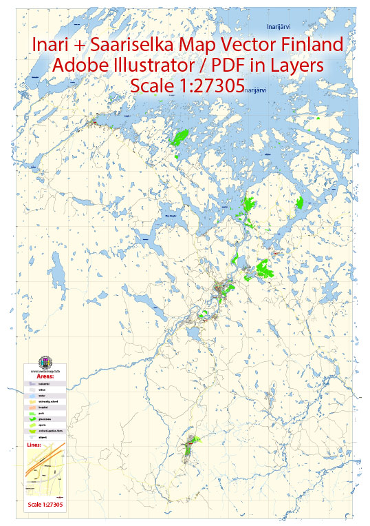
A general overview of the economic and transport connections in the Inari, Ivalo, and Saariselkä regions in Finland.
Vectormap.Net provide you with the most accurate and up-to-date vector maps in Adobe Illustrator, PDF and other formats, designed for editing and printing. Please read the vector map descriptions carefully.
Economic Overview:
1. Traditional Livelihoods:
- The economy in these regions historically relies on traditional livelihoods such as fishing, hunting, and reindeer herding.
- Tourism has increasingly become a significant contributor to the local economy due to the area’s natural beauty, indigenous culture, and outdoor activities.
2. Tourism:
- Inari, Ivalo, and Saariselkä are known for their stunning landscapes, including lakes, forests, and the Northern Lights.
- Winter tourism is particularly popular, with activities like skiing, snowmobiling, and dog sledding attracting visitors.
3. Indigenous Culture:
- The region is home to the Sámi people, and there are efforts to promote and preserve Sámi culture and traditions.
- Local crafts, such as Sámi handicrafts and traditional clothing, are often sold as souvenirs.
Transport Connections:
1. Ivalo Airport:
- Ivalo Airport (IVL) serves as the primary gateway to the region, providing domestic and limited international flights.
- It facilitates tourism and transportation of goods for the local community.
2. Road Transport:
- The road network connects Inari, Ivalo, and Saariselkä, facilitating ground transportation.
- E75 is a major highway in the region, connecting Ivalo to other parts of Finland.
3. Public Transport:
- Public bus services connect these areas, providing transportation for both residents and tourists.
- Due to the relatively remote location, public transport schedules might be less frequent compared to more urban areas.
4. Tourist Transportation:
- Tourist-oriented transportation services, such as shuttle buses and guided tours, are available to explore the natural attractions.
5. Reindeer Sleds and Husky Safaris:
- In winter, traditional modes of transportation, like reindeer sleds and husky safaris, offer unique and immersive experiences for tourists.
Future Developments:
- Finland continues to invest in infrastructure, including transportation, to enhance connectivity to remote areas.
- Sustainable tourism practices are gaining importance, with efforts to balance economic development with environmental conservation.
For the latest and more specific information, it’s recommended to check with local tourism offices, transportation authorities, and economic development agencies. Additionally, consider looking at more recent online sources for the most up-to-date details on economic and transport connections in Inari, Ivalo, and Saariselkä.


 Author: Kirill Shrayber, Ph.D. FRGS