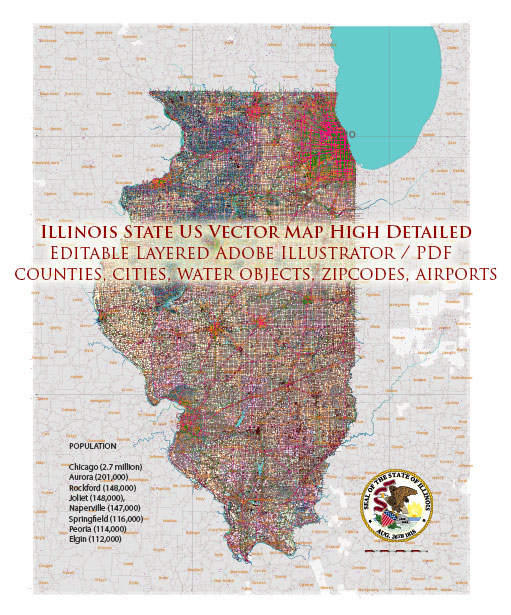
An overview of some of the main cities and railroads in the state of Illinois, USA.
Vectormap.Net provide you with the most accurate and up-to-date vector maps in Adobe Illustrator, PDF and other formats, designed for editing and printing. Please read the vector map descriptions carefully.
Main Cities:
- Chicago: As the largest city in Illinois, Chicago is a major cultural, economic, and transportation hub. It is situated on the southwestern shore of Lake Michigan and is known for its iconic skyline, diverse neighborhoods, and cultural attractions. Chicago is a major center for finance, industry, technology, and transportation.
- Springfield: The capital of Illinois, Springfield is located in the central part of the state. It is known for its historical significance, as it was the home of Abraham Lincoln. Visitors can explore various Lincoln-related sites, including the Abraham Lincoln Presidential Library and Museum.
- Aurora: Located in the outer suburbs of Chicago, Aurora is the second-largest city in Illinois. It has a mix of residential, commercial, and industrial areas, and it offers various recreational opportunities, including parks and cultural events.
- Rockford: Situated in the northern part of the state, Rockford is known for its manufacturing and aerospace industries. It’s the third-largest city in Illinois and has a diverse economy, with a focus on healthcare, education, and tourism.
- Peoria: Located along the Illinois River in the central part of the state, Peoria is an industrial and agricultural center. It has a rich history and is known for its cultural events, including the Peoria Riverfront Museum and the annual Santa Claus Parade.
Major Railroads:
- Union Pacific Railroad: One of the largest and most prominent railroads in the United States, the Union Pacific operates extensive rail lines in Illinois. Its routes connect major cities and industrial centers, facilitating the transportation of goods across the state.
- BNSF Railway: Another major player in the railroad industry, BNSF Railway operates a significant network in Illinois. It plays a crucial role in transporting goods, including agricultural products, consumer goods, and industrial materials.
- Norfolk Southern Railway: Norfolk Southern has a substantial presence in Illinois, providing freight transportation services. Its rail lines connect various cities and serve industries such as manufacturing, agriculture, and energy.
- Canadian National Railway (CN): CN operates railroads in Illinois, contributing to the state’s transportation infrastructure. It facilitates the movement of goods, including commodities like grain, chemicals, and automotive products.
- CSX Transportation: While CSX’s main operations are in the eastern United States, it also has a presence in Illinois. The railroad plays a role in transporting goods and commodities across the state.
These cities and railroads collectively contribute to Illinois’ economic development and play a vital role in the transportation and distribution of goods throughout the region. Keep in mind that the information provided here is a general overview, and specific details may vary.


 Author: Kirill Shrayber, Ph.D.