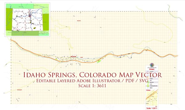
Idaho Springs, located in Clear Creek County, Colorado, is a historic mining town that played a significant role in the development of the region during the Colorado Gold Rush of the 19th century.
Vectormap.Net provide you with the most accurate and up-to-date vector maps in Adobe Illustrator, PDF and other formats, designed for editing and printing. Please read the vector map descriptions carefully.
Here’s a detailed overview of the urban history and street system of Idaho Springs:
Urban History:
- Early Settlement (1859):
- Idaho Springs was founded during the Pike’s Peak Gold Rush in 1859 by George A. Jackson, who discovered gold in Chicago Creek.
- The town quickly grew as prospectors and settlers flocked to the area in search of fortune.
- Mining Boom:
- Idaho Springs became a prominent mining town with numerous gold and silver mines in the surrounding mountains.
- The Argo Gold Mine and Mill, one of the largest and most famous mills of its time, was established in Idaho Springs in 1893.
- Railroad Expansion:
- The arrival of the Colorado Central Railroad in 1877 further fueled the town’s growth, providing a crucial transportation link for mining operations.
- Historical Landmarks:
- The town has preserved several historical landmarks, including the Charlie Taylor Water Wheel, Bridal Veil Falls, and the Historic Chicago Creek Walking Path.
- Decline and Preservation:
- The decline of mining activities in the early 20th century led to a population decrease, but efforts to preserve the town’s historical significance began in the 1970s.
Street System:
- Main Street:
- The heart of Idaho Springs is its Main Street, which runs through the downtown area. It is lined with historic buildings, shops, restaurants, and galleries.
- Historic Buildings:
- Many of the town’s structures date back to the late 19th and early 20th centuries, reflecting the architecture of the mining boom era. Some buildings have been repurposed for modern use.
- Virginia Canyon Road:
- This road, leading out of Idaho Springs, provides access to some of the historic mining areas and offers scenic views of the surrounding mountains.
- Local Infrastructure:
- The street system is designed to accommodate both local residents and the influx of tourists who visit the town for its historical charm and outdoor activities.
- Adaptation to Modern Times:
- While maintaining its historic character, Idaho Springs has adapted to modern needs, with infrastructure improvements, parking facilities, and amenities catering to contemporary residents and visitors.
- Tourist Attractions:
- The town’s street system connects visitors to attractions such as the Idaho Springs Heritage Museum, which showcases the town’s rich history.
- Recreational Trails:
- The Clear Creek Greenway and Miner Street Park are examples of areas where the street system integrates with recreational spaces, allowing residents and visitors to enjoy outdoor activities.
In summary, Idaho Springs’ urban history is deeply rooted in the mining boom of the late 19th century, and its street system reflects a balance between preserving its historic charm and adapting to the needs of a modern community. The town continues to be a popular destination for those seeking a glimpse into Colorado’s mining past and enjoying the natural beauty of the surrounding mountains.


 Author: Kirill Shrayber, Ph.D.