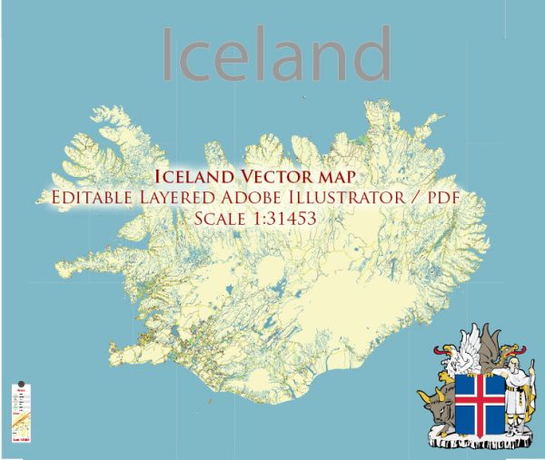
Iceland is a Nordic island country located in the North Atlantic Ocean. It is known for its stunning natural landscapes, including glaciers, hot springs, waterfalls, and volcanic activity. While Iceland is not densely populated, it does have several notable cities and towns, and the road network plays a crucial role in connecting these settlements.
Vectormap.Net provide you with the most accurate and up-to-date vector maps in Adobe Illustrator, PDF and other formats, designed for editing and printing. Please read the vector map descriptions carefully.
Main Cities and Towns:
- Reykjavik:
- Reykjavik is the capital and largest city of Iceland, situated on the southwest coast.
- It is the cultural, economic, and political center of the country.
- Landmarks include the Hallgrímskirkja church, Harpa Concert Hall, and the Sun Voyager sculpture.
- Akureyri:
- Located in the north of Iceland, Akureyri is the second-largest urban area.
- It is known for its botanical gardens, the Akureyri Church, and the Hof Cultural and Conference Center.
- Hafnarfjörður:
- A town in the Capital Region, adjacent to Reykjavik.
- Known for its unique lava fields, cultural events, and the annual Viking Festival.
- Kópavogur:
- Also part of the Capital Region, Kópavogur is the second most populous town in Iceland.
- It has a modern art museum and several outdoor recreational areas.
- Selfoss:
- Located in the South Region, Selfoss is a town situated on the banks of the Ölfusá River.
- It serves as a gateway to popular tourist destinations in southern Iceland.
Principal Roads:
- Ring Road (Route 1):
- The most important highway in Iceland, encircling the entire island.
- It connects major cities and towns, offering breathtaking views of diverse landscapes.
- Golden Circle:
- A popular tourist route covering about 300 kilometers and connecting Reykjavik, Þingvellir National Park, Geysir geothermal area, and Gullfoss waterfall.
- Kaldidalur Highland Route:
- A mountain road connecting Þingvellir and Húsafell, providing access to the interior highlands.
- Sprengisandur Highland Route:
- Another highland road crossing the desolate interior, connecting the north and south regions.
- Hringvegur (Ring Road) in Reykjavik:
- The capital has its own Ring Road, which encircles the city and connects its various neighborhoods.
- Snæfellsnesvegur (Road 54):
- Takes you around the Snæfellsnes Peninsula, known for its dramatic coastline and the Snæfellsjökull glacier.
- Akureyrarvegur (Road 1):
- Connects Reykjavik and Akureyri, providing a picturesque journey through northern Iceland.
Iceland’s road network is crucial for exploration, and it’s important to note that some interior roads may be impassable during winter due to snow and challenging weather conditions. Travelers should always check road conditions and weather forecasts before embarking on a journey, especially in remote areas.


 Author: Kirill Shrayber, Ph.D. FRGS