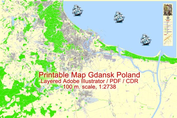
Gdańsk, located on the Baltic Sea in northern Poland, has a rich history and a well-developed transportation infrastructure.
Vectormap.Net provide you with the most accurate and up-to-date vector maps in Adobe Illustrator, PDF and other formats, designed for editing and printing. Please read the vector map descriptions carefully.
Here’s a detailed overview:
History:
- Early History: Gdańsk has a history dating back over a thousand years. It was initially a small settlement of the Baltic tribe known as the Goths.
- Medieval Period: In the 10th century, Gdańsk became part of the Polish state. It developed as a trade center due to its strategic location on the Amber Road, a trade route connecting the Baltic Sea with the Adriatic Sea.
- Teutonic Knights: The Teutonic Knights took control of Gdańsk in the 14th century, and it became a member of the Hanseatic League, a powerful trade alliance of merchant cities.
- Royal Prussia: After the Thirteen Years’ War in the 15th century, Gdańsk became part of the Kingdom of Poland as a semi-autonomous city known as Royal Prussia.
- Polish-Lithuanian Commonwealth: Gdańsk flourished in the 16th and 17th centuries, becoming a major European trading hub. The city was a melting pot of cultures, with Polish, German, and Dutch influences.
- Partitions of Poland: Gdańsk experienced a decline in the late 18th century due to the partitions of Poland, during which it was annexed by Prussia. It regained its independence after World War I.
- World War II: Gdańsk was heavily damaged during World War II. The post-war period saw the city reconstructed, with the historic center being meticulously restored.
- Solidarity Movement: In the late 20th century, Gdańsk gained international prominence as the birthplace of the Solidarity movement, a trade union led by Lech Wałęsa that played a crucial role in the downfall of communism in Poland.
Transportation Infrastructure:
- Gdańsk Lech Wałęsa Airport: The city is served by the Gdańsk Lech Wałęsa Airport, named after the Nobel laureate and former Polish President. It is the primary international airport in the region.
- Port of Gdańsk: The Port of Gdańsk is one of the largest and most modern seaports on the Baltic Sea. It has been a crucial hub for international trade throughout history.
- Rail and Road Networks: Gdańsk is well-connected by rail and road. The city has a central railway station, providing efficient connections to other major Polish cities and European destinations. The road network includes highways and expressways linking Gdańsk to the rest of Poland and neighboring countries.
- Public Transportation: Gdańsk has an extensive public transportation system, including buses and trams, making it easy for residents and visitors to move around the city.
- Maritime Transportation: Given its coastal location, maritime transportation plays a significant role. Ferries connect Gdańsk with nearby ports, enhancing connectivity with Scandinavia.
- Bicycle Infrastructure: Gdańsk has been working on developing a bicycle-friendly infrastructure with dedicated lanes and bike-sharing programs, promoting sustainable and eco-friendly transportation.
Gdańsk’s history and transportation infrastructure together make it a vibrant and dynamic city with a blend of historical charm and modern connectivity.


 Author: Kirill Shrayber, Ph.D.