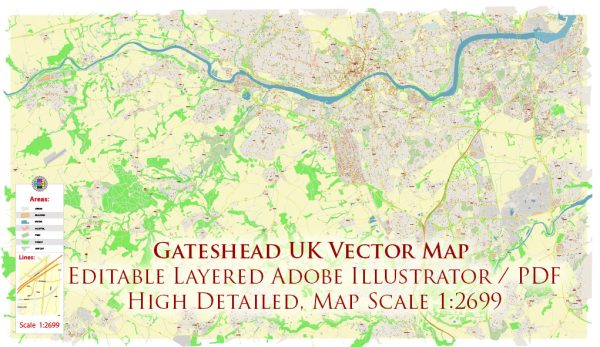
Gateshead is a town in Tyne and Wear, England, situated on the southern bank of the River Tyne opposite Newcastle upon Tyne. The history of Gateshead is intertwined with the broader history of the region and its industrial development.
Vectormap.Net provide you with the most accurate and up-to-date vector maps in Adobe Illustrator, PDF and other formats, designed for editing and printing. Please read the vector map descriptions carefully.
Here is a brief overview of the history and transportation infrastructure of Gateshead:
History:
- Early History: The area that is now Gateshead has a long history dating back to Roman times. The Romans built a fort called Pons Aelius on the site of present-day Newcastle, and Gateshead likely played a role in supporting the fort.
- Medieval Period: Gateshead evolved as a small settlement during the medieval period. The town’s name is thought to derive from the Old English words “geat” (meaning gate or road) and “heafod” (meaning head or headland), referring to its position at the head of a major transportation route.
- Industrial Revolution: The 18th and 19th centuries saw the rapid industrialization of the region, with coal mining, iron and steel production, and shipbuilding becoming prominent industries. The growth of industry brought prosperity to Gateshead, as it played a crucial role in supplying coal to the expanding industrial centers.
- Twentieth Century: Like many industrial towns, Gateshead faced economic challenges in the 20th century as traditional industries declined. However, efforts were made to regenerate the area, and today it is known for cultural attractions, including the Baltic Centre for Contemporary Art.
Transportation Infrastructure:
- River Tyne: The River Tyne has played a pivotal role in the transportation history of Gateshead. The town developed as a port, facilitating the export of coal and other goods. Bridges such as the Swing Bridge and the High Level Bridge connected Gateshead to Newcastle, enabling the movement of people and goods.
- Railways: The development of railways in the 19th century further enhanced transportation connectivity. The Newcastle and Carlisle Railway and later the East Coast Main Line connected Gateshead to other major cities.
- Roads: The road network in and around Gateshead has been modernized to accommodate the increasing traffic demands. Major roads, including the A1(M) motorway, provide vital links to nearby towns and cities.
- Bridges: Gateshead is known for its iconic bridges. The Gateshead Millennium Bridge, opened in 2001, is a tilting bridge that spans the River Tyne, connecting Gateshead to Newcastle. The Quayside area has seen significant redevelopment, enhancing the transportation and recreational aspects of the region.
- Public Transport: The town is served by bus services, providing local and regional connectivity. Additionally, the Tyne and Wear Metro system connects Gateshead to other parts of the Tyne and Wear metropolitan area.
Overall, Gateshead’s history is marked by its industrial past, and its transportation infrastructure has evolved to meet the changing needs of the region, blending historical elements with modern developments.


 Author: Kirill Shrayber, Ph.D. FRGS